Executive Summary: Digital 3D building models created from drone surveys will be the central working foundation for solar installers, roofers, scaffolders, and planners by 2026. When all trades are involved early on in a shared model, you reduce follow-up questions, rework, and on-site stress - and you benefit from a consistent data basis from proposal through to ongoing maintenance.
Core Message: More clarity, fewer questions - With a single, precise 3D model, you manage proposals, construction, and service instead of treating each phase as a separate task.
1. Why Solar Installers Need a Digital Foundation for Their Process Chain by 2026
PV projects today are complex collaboration projects:
- Solar installers design and install the system.
- Roofers ensure structural integrity, connection details, and any refurbishment work.
- Scaffolders provide safe access.
- Planners, energy consultants, and building owners make robust, data-based decisions.
In practice, these interfaces are still often managed via:
- 2D plans and photos
- Handwritten measurements
- Separate Excel spreadsheets
- Email attachments instead of clear site coordination
This leads, in day-to-day operations, to:
- Last-minute questions right before installation ("Does the scaffold fit?" "Where is the inverter located?")
- Rework due to missing or inaccurate measurements
- Uncertainty around structural calculations, crane placement, and material logistics
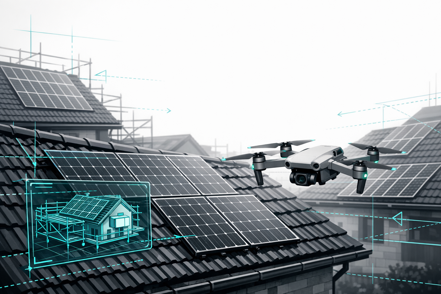
Airteam's own analyses and customer case studies show: Precision at the start of the chain is the key. Drone surveying cuts the time needed for roof measurements by up to 90% and usually delivers a verifiable 3D model within 24 hours - the foundation for truly digital construction planning.
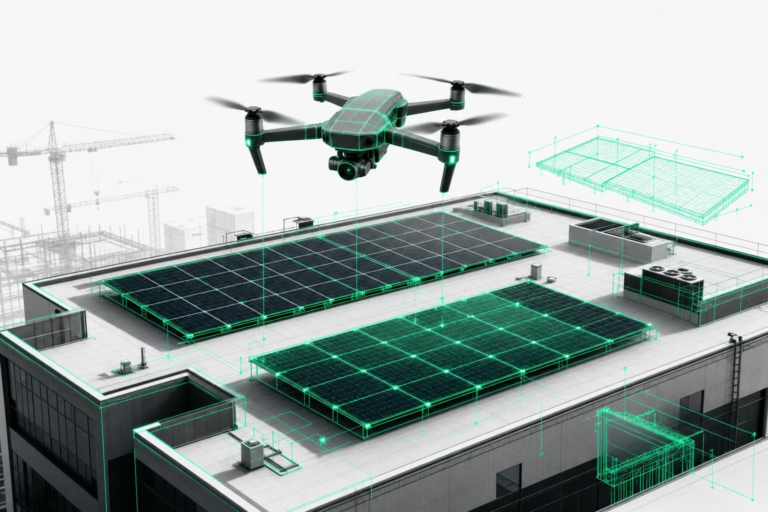
2. The 3D Building Model as a Shared Language for All Stakeholders
At the heart of BIM and modern 3D planning is a simple idea: everyone works on the current building model instead of each party using their own separate data.
2.1 What a Central 3D Model Must Deliver
An effective 3D model for solar installers and trades must provide:
- Geometric precision (roof, slopes, dormers, structures)
- Standards-compliant measurement data for contract-compliant proposals and static calculations
- Direct measurability (lengths, areas) without needing CAD skills
- Sharing & commenting (link sharing, screenshots, notes)
- Export to industry-standard formats (PV software, CAD, scaffolding and timber construction)
This is exactly where the Airteam Fusion Platform comes in: AI-supported drone imagery generates precise 3D models with classified building elements. Data can be exported, for example, to PV*SOL, Eturnity, AutoCAD, SketchUp, or Scaffmax.
2.2 Stakeholder Perspectives - Everyone Sees the Same Roof
Solar installer
- Uses the 3D model for digital site measurements, module layout, shading analysis, and cable routing.
- Saves on-site visits because all measurements are centrally available.
- Backs up proposals with 3D views and gives customers confidence.
Roofer
- Checks roof condition and details, and plans refurbishment steps directly in the model.
- Works from the same planning foundation as the solar installer.
Scaffolder
- Plans the scaffold digitally and reduces the risk of misallocation or incorrect configuration.
- Determines eave heights and obstacles directly in the model.
Building owner / property operator
- Sees the property, often for the first time, as a continuous 3D model.
- Gains transparency: Where will the scaffold stand? How will the PV system fit?
- Benefit: more trust and confidence in decision-making.
The result is a digital single source of truth - a shared visual language replaces time-consuming coordination.
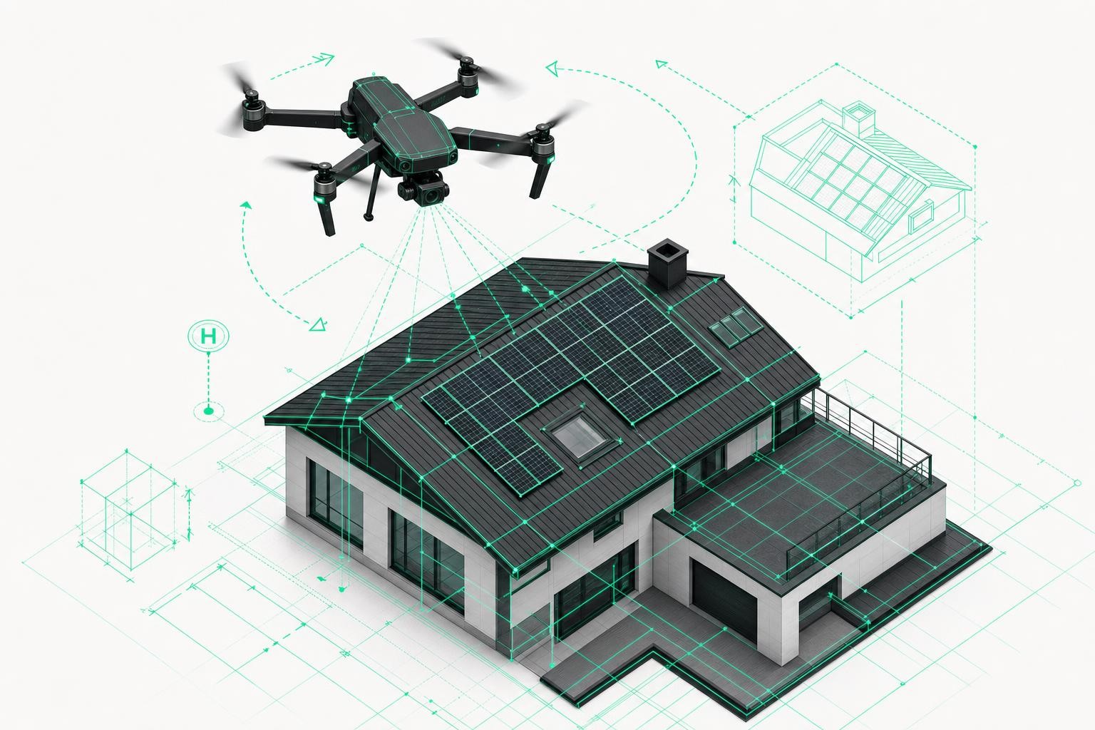
3. From Survey to Maintenance: One 3D Model for the Entire Process Chain
The real advantage emerges when you use a single digital survey throughout the entire project.
3.1 Proposal Phase: Fast, Precise, Persuasive
- A drone flight (in-house or with a pilot) captures the property in minutes.
- The Airteam Fusion Platform automatically generates the 3D model and planning data.
- Proposals are enhanced with screenshots and a viewer link.
The time required to prepare proposals for PV projects drops by up to 90% - you reach the customer faster than your competitors.
Airteam customers report measurable gains: Roofing company Mann increases its proposal win rate by 23% with 3D site measurements; Pro Electrify achieves 38% more closed deals and over 90% fewer measurement errors
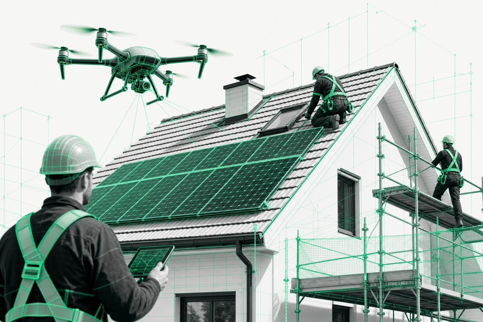
3.2 Construction Phase: Less Friction on Site
With a 3D model, you benefit in multiple aspects of construction management:
- Material planning: Exact measurements prevent over- or under-ordering. Load calculations are based on precise areas.
- Scaffolding: Scaffolders plan and measure in the model. Eave and ridge heights are clearly visible.
- Crane and logistics planning: Open areas and access routes are checked digitally and coordinated with all parties.
- Site coordination: All trades work from the same data foundation - details are discussed directly in the viewer.
Real-world examples show: Roofing company Mann completes the measurement of a 6,000 m² roof with over 100 dormers in two days using Airteam - instead of several weeks. That creates room for more projects.
3.3 Documentation, Service & Maintenance
After installation, the 3D model continues to add value:
- Handover & documentation: Detailed documentation before and after installation. Disputes about building damage can be clarified using photos and the model.
- Inspection & maintenance: Follow-up flights (e.g. thermography) are referenced to the original model, allowing hotspots or issues to be pinpointed accurately.
- Upgrades: For later refurbishments or PV system expansions, the model is available as a BIM-ready foundation.
Example of interior/exterior combination: Stadtwerke München and Lumoview combine Airteam 3D data of the building envelope with interior scans to create full BIM models - 86% faster and around 90% cheaper than traditional methods
4. Concrete Impact on Site Coordination and Rework
How do digital models make a difference in practice?
4.1 Typical Bottlenecks Without Digital Site Measurement
- Repeated re-measuring
- Unclear responsibilities when measurements don't match
- Unplanned modifications on site
- Time lost due to back-and-forth queries ("Send another photo...")
Airteam estimates the error rate of manual measurements at 5-10% - enough to cause regular inaccuracies and subsequent recalculations
4.2 With a 3D Model: Less Friction, More Throughput
Digital 3D planning sustainably improves coordination quality:
- Fewer questions: Shared geometry data, clarification via screenshots.
- Less rework: Standards-compliant, certified site measurements reveal planning errors early.
- Faster decisions: Customers see their project clearly and make decisions more quickly.
Airteam data: Over 5,000 companies use drone surveying and 3D models from Airteam; more than 70,000 projects have been handled digitally - digital site measurement is already established.
4.3 Comparison: Process With and Without a 3D Model
| Project phase | Without digital site measurement | With 3D model & Airteam Fusion Platform |
|---|---|---|
| Surveying | 2-4 hours manually on the roof, high accident risk | 5-15 minutes drone flight from the ground |
| Data preparation | Hand sketches, manual input into software | Automatic cloud processing, finished model |
| Proposal quality | Estimates, change orders likely | Reliable calculations, contract-compliant areas |
| Site coordination | Many separate arrangements, unclear responsibilities | Shared 3D model as a common reference |
| Documentation & maintenance | Collections of photos, hard to match to locations | 3D twin with history and additional data |
A single-family home can be captured with Airteam in 10-15 minutes by drone - instead of 1-1.5 hours of conventional measuring. This makes significantly more projects per week feasible.
5. How Airteam Makes BIM Workflows & Digital Construction Planning Practical for Trades
BIM does not have to be complicated. For solar companies, it is often enough to systematically connect data for roofs, façades, and, where necessary, interiors.
5.1 Technical Foundation: Accuracy & Compliance with Standards
Airteam contributed to the DIN SPEC 5452-5 standard for drone-based site measurements. With RTK drones, up to 99.9% accuracy with 1-3 cm tolerance at 40 m altitude can be achieved
This level of precision is sufficient for:
- PV structural analysis and load distribution
- Contract-compliant billing
- Scaffolding and timber construction planning
5.2 A Continuous Process Foundation Instead of Isolated Solutions
The Airteam Fusion Platform supports all phases:
- Acquisition & proposal: 3D visualizations, viewer links, accurate quantities
- Planning: Export to more than 15 relevant formats
- Execution: Access for installers, scaffolders, and roofers
- Maintenance: Reuse of the model for service and inspections
The principle: Created once, used many times - the 3D model pays off across the entire project.
5.3 Flexible Use with Flat Rates & Credits
- Flat rates (Fast/Pro/Max/Ultra Fusion) for recurring standard projects
- Airteam Credits extend surface area coverage or add planning data
You start flexibly and scale as needed.
You can find more hands-on examples in the success stories and in the section Perfect PV planning with drones and AI.
6. Step-by-Step: How to Integrate 3D Models into Your PV Process Chain
Step 1: Define a Pilot Project
- Choose a typical project (e.g. single-family home, small commercial roof)
- Decide which trades will be involved
- Set objectives: e.g. time savings, fewer reworks, faster proposals
Step 2: Use Digital Site Measurement & the 3D Model
- Perform a drone flight (your own drone or an Airteam pilot)
- Upload the images to the Airteam Fusion Platform
- Use the 3D model as a team for:
- PV layout and cable routing
- Scaffold and crane planning
- Clarifying details (penetrations, shading, safety zones)
Step 3: Establish a Standard Process
- Define from which project size digital site measurement becomes your standard
- Assign responsibilities (flying, validating the model, sharing the viewer link)
- Track impact: time savings, fewer questions, fewer errors, higher close rates
Get started with a flat rate or a one-off project - see the overview under Prices & flat rates. You can also book a free demo and experience the workflow in action.
Frequently Asked Questions
How does this fit with BIM - do I need full-scale BIM expertise?
No. For most trades, the focus is on an accurate digital twin of the roof and façade. Airteam delivers centimeter-accurate 3D models that can be combined with interior scans into BIM models if needed - as done by Stadtwerke München and Lumoview. You can start pragmatically and evolve over time.
Do I need CAD or 3D experience to use the Airteam Fusion Platform?
No. The cloud software is designed for construction trades. You upload drone images, AI generates the 3D model and planning data. You measure areas and slopes directly in your browser.
How quickly will I receive the 3D model after the drone flight?
The validated model is usually available within 24 hours. For a single-family home, a 5-15 minute drone flight is enough, and evaluation runs automatically in the cloud
How exactly does a 3D model reduce rework and follow-up questions?
Everyone accesses the same certified data foundation:
- Solar installers, roofers, and scaffolders see identical measurements
- Planning errors are identified early - before materials are ordered
- You answer customer questions directly in the model, which minimizes recalculations and incorrect orders
Can Airteam integrate with my existing PV design software?
Yes. The Airteam Fusion Platform exports to more than 15 formats, for example for PV*SOL, Eturnity, SolarEdge Designer, SEMA, Scaffmax, AutoCAD, and SketchUp. This turns your 3D model into the central data base for your entire project workflow.
Conclusion:
Building together starts in the digital 3D model. With digital site measurement, 3D planning, and practical BIM, you create a seamless process foundation as a solar installer - from the first roof scan through to maintenance. The Airteam Fusion Platform provides this infrastructure as a user-friendly cloud solution: ready to deploy in your business right away.