Digitalization is transforming the trades - and roof surveying is right at the heart of this shift. For decades, contractors climbed onto roofs with tape measures and scaffolding; today, drones enable precise measurements from the ground. But which method actually delivers the best results for roofers, solar installers, and other trades? This in-depth comparison walks you through the differences between traditional measurement, satellite-based surveys, and modern drone surveying - with concrete figures, costs, and real-world examples.
The three main roof surveying methods compared side by side
Manual roof measurement - The traditional approach
Manual roof measurement is the classic method where tradespeople climb directly onto the roof with a tape measure, folding rule, or laser distance meter. Experienced roofers know every step: measuring rafter lengths, capturing dormers, determining roof pitches.
Method: Point-by-point measurement of all relevant roof areas and details
Time required: 4-8 hours for an average single-family home; several days for complex roofs
Accuracy: 5-15 cm deviation due to measurement errors and poor accessibility
Cost per job: €200-€800 for scaffolding rental plus labor costs
The biggest challenges: Hard-to-reach areas are often only roughly captured, and manually transferring measurements into planning documents is error-prone. Especially on steep roofs or intricate buildings, estimates quickly lead to problems in material calculations.
Satellite surveys - Fast but inaccurate
Satellite-based measurements use publicly available aerial imagery such as Google Maps or specialized geodata providers. Measurements are taken digitally on a computer using pre-existing satellite images.
Method: Digital area calculation using aerial imagery with manual post-processing
Time required: 30 minutes to 2 hours for digital evaluation
Limitations: Only rough estimates, not compliant with industry standards, no consideration of roof details
Accuracy issues: Deviations of several meters due to outdated images and shading from trees and neighboring buildings
Satellite surveys are suitable only for initial cost estimates or feasibility checks. For professional quotes and material billing, the accuracy is insufficient - costly rework is almost guaranteed.
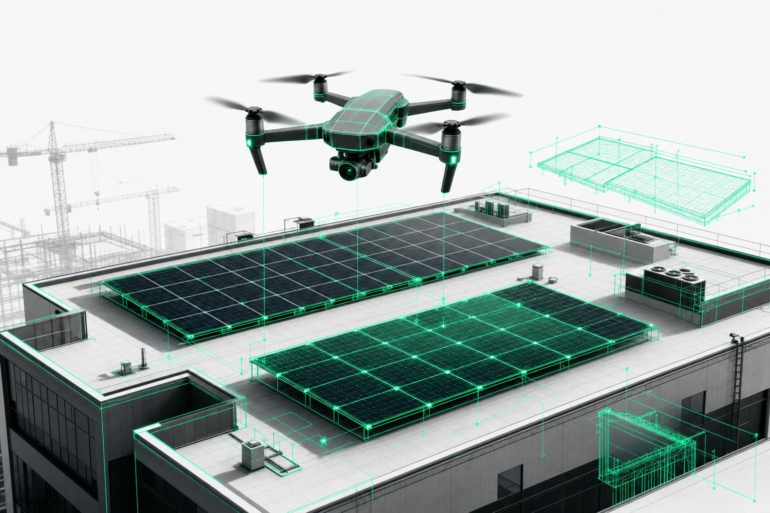
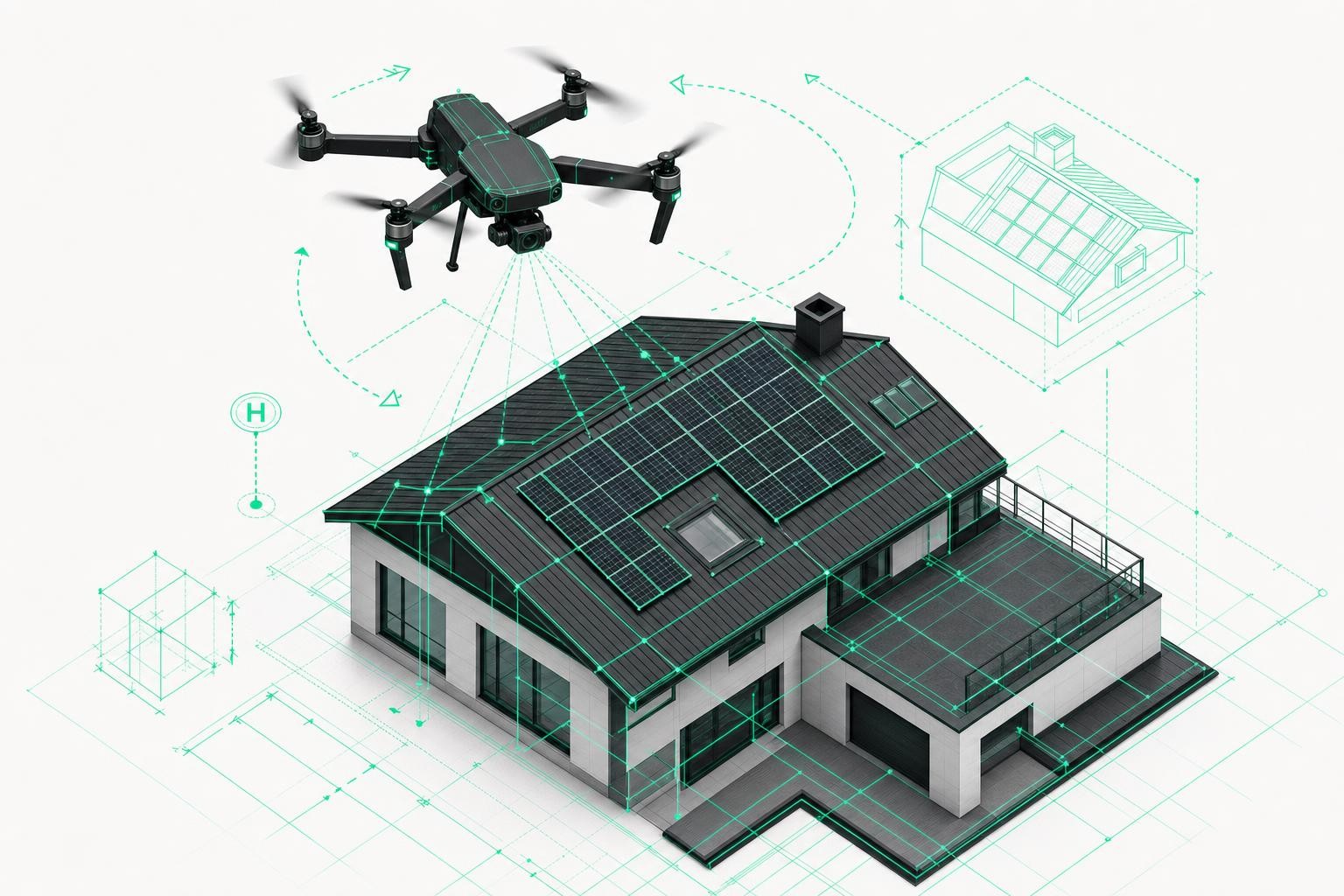
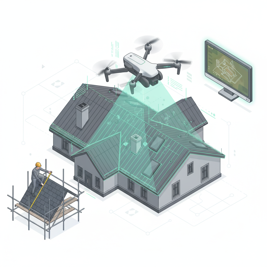
Drone surveying - The modern solution
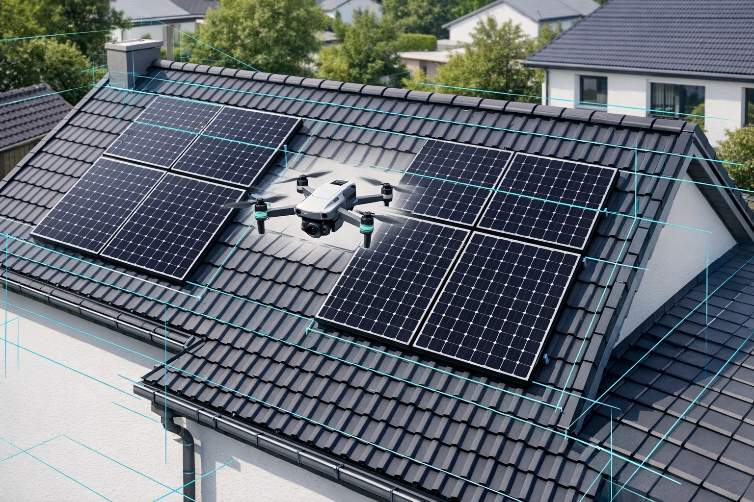
Drone surveying combines modern UAV technology with AI-powered photogrammetry. A short drone flight captures hundreds of high-resolution photos, which are automatically processed into an accurate 3D model.
Technology: DJI drones with RTK precision and the Airteam AI pipeline for automatic model generation
Accuracy: Achieves DIN-compliant standards with only 1-3 cm tolerance at 40 meters
Speed: 15-30 minutes flight time, 24 hours automatic processing to a finished 3D model
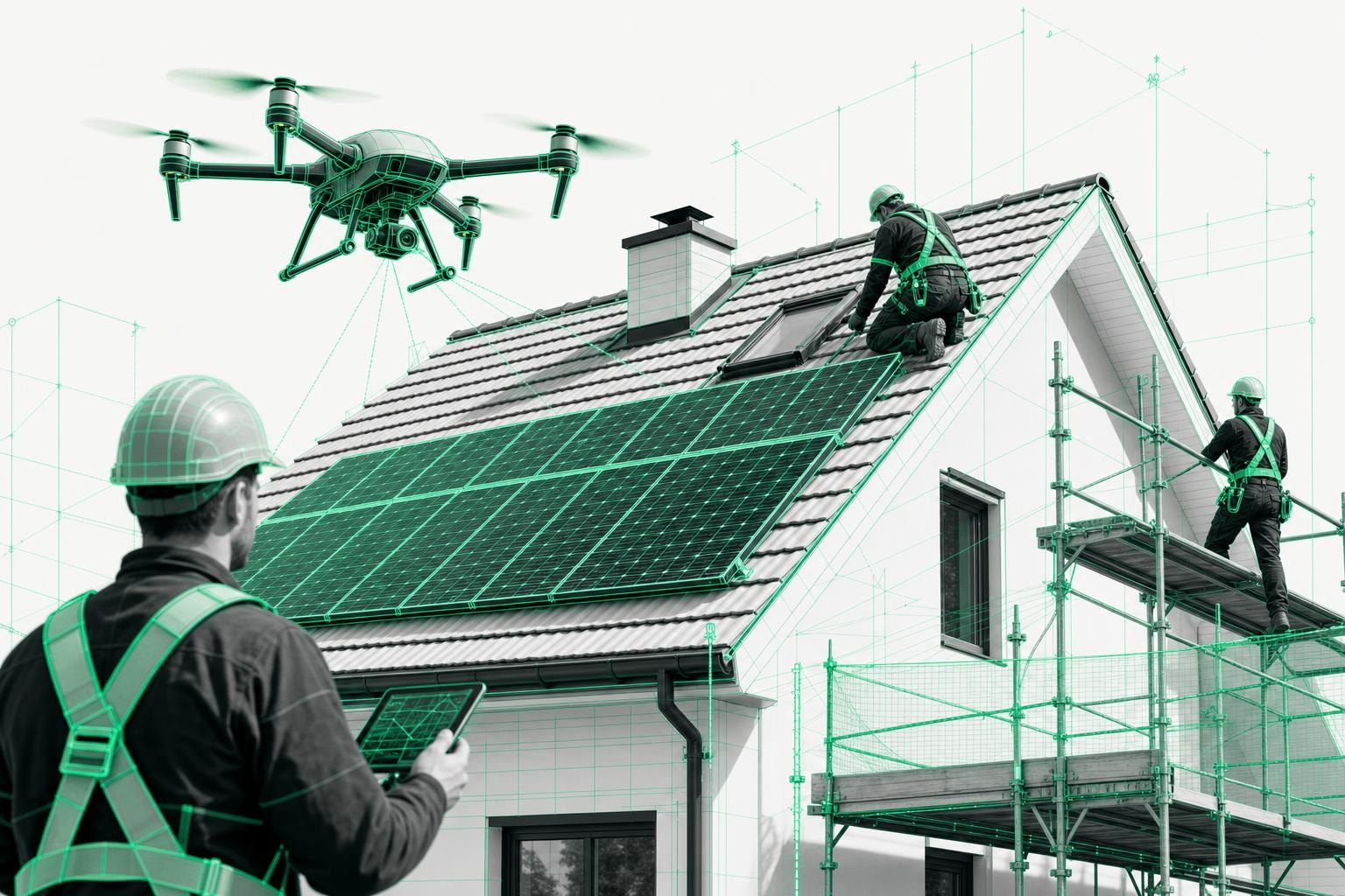
Safety: Complete measurement from the ground - no need to step onto the roof
The Airteam platform automatically converts drone imagery into DIN-compliant planning documents that can be exported directly into standard industry software such as MF Dach, PV*SOL, or AutoCAD.
Accuracy comparison: Centimeters vs. meters of deviation
Precision in detail
Modern drone surveying reaches professional survey-grade accuracy:
- RTK drones: 1-3 cm tolerance at 40 m thanks to real-time kinematic correction with satellite data
- DIN-compliant accuracy: Meets German surveying standards with high precision
- Highly detailed capture: Every valley, dormer, and roof edge is documented with centimeter-level precision
- Repeatability: Identical results when measuring the same object multiple times
Traditional methods in comparison:
- Manual measurement: 5-15 cm deviation due to measurement errors, especially on difficult roof sections
- Satellite surveys: 50 cm to several meters deviation because of outdated imagery and perspective distortions
- Estimates: Up to 20% material waste due to inaccurate area calculations
Significantly more accurate than conventional satellite data
Airteam drone surveying is far more accurate than satellite data and clearly surpasses airplane-based aerial imagery in terms of precision. This level of accuracy has a direct impact on your material calculations and profit margin.
Practical example - roof renovation: For a 200 m² pitched roof, a 10% inaccuracy leads to 20 m² of excess material. With roof tiles at €25/m², that adds up to €500 in additional material costs - not counting the labor for extra orders and project delays.
Concrete effects of higher precision:
- Material ordering: Exact quantities without 15-20% safety buffers
- Quote reliability: DIN-compliant quantities build trust with clients and in tender processes
- Profit optimization: No hidden extra costs caused by miscalculations
Cost analysis: What does each measurement method really cost?
Key cost factors at a glance
| Method | Initial investment | Per measurement | Time required | Follow-up costs |
|---|---|---|---|---|
| Manual | €200-€500 (measuring equipment) | €400-€1,200 | 4-8 hours | Scaffolding, insurance, rework |
| Satellite | €50-€200/month | €30-€80 | 30-120 min | Additional on-site measurement required |
| Drone | From €1,950 | €125/month and up | 15-30 min flight | No rework |
Hidden costs of traditional methods
Scaffolding rental and logistics:
- Assembly/disassembly: €300-€600 per job for single-family homes
- Transport: €150-€250 depending on distance
- Rental period: €50-€100 per day for longer projects
Labor costs and safety:
- Skilled worker 4-8 hours: €240-€560 at €70 per hour
- Higher insurance premiums due to working at height
- Downtime caused by bad weather or accidents
Rework caused by measurement errors:
- Additional material orders: 5-15% of project costs
- Delays: Extra site visits and coordination effort
- Customer satisfaction: Complaints due to late completion
ROI of drone surveying
Investment calculation for the Airteam Starter Set:
- Fast Fusion Set: From €1,950 including DJI Mini 3 and basic software access
- Payback period: With 10 projects per month, the investment pays off after only 3-4 months
- Long-term savings: Significant time savings, no scaffolding costs for measurement, no repeat surveys
Sample calculation for a roofing company:
- Traditional: €800 per measurement (scaffolding + labor + additional material orders)
- Drone: €200 per measurement (Airteam credits + 30 minutes of labor)
- Savings: €600 per project × 20 projects = €12,000 per year
Efficiency and time savings - The decisive factor
From hours to minutes
Traditional workflow: Travel to site -> Set up scaffolding -> Walk the roof -> Measure -> Sketch -> Return to office -> Digitize -> Calculate
Total time: 6-10 hours from request to finished quote
Drone workflow: Travel to site -> 15-30 minutes flight -> Upload -> Automatic processing -> Export -> Quote
Total time: 2-3 hours from request to finished quote
Specific time savings:
- On-site time: Significant reduction by eliminating scaffolding work for measurement
- Post-processing: Far less office work thanks to automatic 3D model generation
- Quote creation: Direct data transfer into estimating and calculation software
Productivity boost for your trade business
More projects per day:
- Traditional: 1-2 roof measurements per day
- With drones: 8-12 measurements per day thanks to short flight times
- Parallel processing: While one project is being processed, additional roofs can already be flown
Faster customer service:
- 24-48 hours: From drone flight to finished quote
- 3D visualization: Impressive presentations for clients increase your close rate
- Reliable scheduling: Accurate material quantities enable dependable delivery dates
Optimized material logistics:
- Just-in-time: Ordering precisely calculated material quantities
- Reduced stock levels: Less capital tied up thanks to demand-based procurement
- Less waste: Millimeter-level planning minimizes material offcuts and wastage
Safety aspects: Protecting lives through technology
Accident statistics in roofing
Roofing is among the most hazardous trades: In the USA, about 134 fatal work accidents are reported annually. Injury statistics show around 7,100 injuries related to roofing work in 2021. The main cause is falls during roof access and roof walks - precisely the activities required for traditional measurements.
Typical causes of accidents during roof measurements:
- Slipping on wet or steep roof surfaces
- Breaking through rotten roof sections or skylights
- Falling while trying to reach hard-to-access roof areas
- Weather conditions: Wind, rain, or ice
Drones eliminate the risk of working at height
The zero-risk principle of drone surveying:
- Ground-based measurement: Complete capture without stepping onto the roof
- Hard-to-reach areas: Drones safely and precisely access every corner of the roof
- More weather-tolerant: Measurements are possible even in light rain or wind up to 12 m/s
- Consistent safety: Identical safety standards for every survey
Insurance benefits:
- Lower liability premiums due to reduced accident risk
- No need for specialized working-at-height insurance for measurement tasks
- Better conditions thanks to demonstrably safer working practices
Compliance and documentation:
- Complete digital documentation of all measurements
- Traceability via GPS coordinates
- Timestamps for seamless project documentation
Technical integration and workflow optimization
From measurement to finished planning
The Airteam 5-step process:
- Drone flight: 15-30 minutes on site with automated flight patterns
- Upload: Direct transfer of images to the Airteam cloud platform
- AI processing: Automatic 3D model creation by artificial intelligence within 24 hours
- Quality check: Manual verification of all dimensions and details by experts
- Export: Download in more than 15 file formats for all common industry applications
Automated data processing:
- Semantic detection of roof elements: Dormers, chimneys, skylights
- Automatic area calculation including material requirements
- Pitch analysis for drainage and solar potential
Software compatibility and standards
Seamless integration into existing workflows:
- MF Dach: Direct import of areas and dimensions for cost calculations
- PV*SOL: Fully preconfigured roof models for solar design
- AutoCAD/SketchUp: DWG and 3D exports for detailed planning
- Eturnity: Automated solar yield calculations using precise roof geometries
Export formats for every need:
- 2D plans: PDF, DXF, DWG with all dimensions
- 3D models: PLN, SKP, IFC for BIM workflows
- Data feeds: CSV, Excel for estimating and calculation tools
- Visualizations: JPG, PNG, MP4 for client presentations
Compliance and standards:
- Area calculation compliant with DIN 18960
- Specifications compatible with VOB/C
- BIM-ready data structure for digital planning and construction
Real-world examples: What trade businesses report
Success stories from the industry
Trade businesses across Germany are already using drone surveying successfully. Their experience shows consistently positive effects on efficiency, accuracy, and customer satisfaction.
Typical improvements after switching:
- Significant time savings in project delivery
- Far fewer measurement errors thanks to automated data capture
- Noticeable cost reductions from eliminating scaffolding for measurement
- Higher win rates through professional 3D presentations
Use cases across different trades
Roof renovation and new construction:
- Precise material calculation for roof tiles, insulation, and substructures
- Detailed planning for dormers, chimneys, and roof windows
- Inclusion of all roof build-ups for accurate cost calculations
- 3D visualizations for client presentations and permitting processes
Photovoltaic installation:
- Optimal module alignment based on precise pitch analysis
- Shading analysis using a 3D model of the surroundings
- Structural assessment based on exact load distribution
- Direct export into design tools such as PV*SOL and SolarEdge Designer
Scaffolding and façade refurbishment:
- Millimeter-accurate façade measurements without extensive on-site survey work
- Accurate scaffolding planning reduces material and transport costs
- 3D documentation for billing and construction progress tracking
- Export to Scaffmax for automated scaffolding calculations
Carpentry and roof structures:
- Exact rafter lengths and spacing for prefabrication
- 3D models for CNC cutting and assembly systems
- Clash detection for roof extensions and additions
- Integration into SEMA and other timber construction software
FAQ: The most common questions about drone roof surveying
Is drone surveying really more accurate than manual measurement?
Yes. Modern RTK drones achieve DIN-compliant accuracy with only 1-3 cm tolerance at 40 meters. This is significantly more precise than manual measurements, which often have deviations of 5-15 cm due to difficult access and human error.
What does it cost to switch to drone surveying?
Airteam Starter Sets start at €1,950, including the drone and software access. The investment typically pays for itself after 5-10 projects thanks to time savings and the elimination of scaffolding costs for measurement. Monthly flat-rate plans start at €125.
Do I need a drone license for surveying?
For commercial drone flights in the EU, the A1/A3 certificate of competency is required. Alternatively, you can book experienced Airteam pilots for individual projects. Training is already included in the Starter Sets.
Does drone surveying work in bad weather?
Drones are more weather-tolerant than manual measurements. Surveys are possible in light rain or winds up to 12 m/s. Only during thunderstorms or storms should flights be avoided - times when manual measurements would not be possible either.
How long does it take to process the drone data?
The 3D model is available within 24 hours. Detailed planning data with all exports are generated automatically within 2-7 business days, depending on project size. Express services are available for urgent cases.
Conclusion: The future of roof surveying is digital
Summary of key advantages
Drone surveying offers substantial time savings, significantly higher accuracy than conventional satellite data, and completely eliminates safety risks during measurement. The technology has the potential to fundamentally transform trade businesses.
The most important arguments for drone surveying:
- DIN-compliant accuracy: High precision with only 1-3 cm tolerance for legally sound billing
- Drastic time savings: Significantly faster than manual measurement thanks to automated processing
- Maximum safety: The zero-risk principle completely removes the need for dangerous roof walks
- Long-term cost reduction: ROI after just 5-10 projects, with substantial savings over time
- Seamless integration: Export to more than 15 formats for all common industry tools
Recommended next steps for trade businesses
Getting started in three steps:
- Consultation: Free potential analysis tailored to your business
- Pilot project: Test the technology on an initial reference property
- Starter Set: Invest in a complete hardware and software package
Drone surveying is no longer a vision of the future - it is already standard practice in leading trade businesses. Companies that make the switch now secure a decisive competitive advantage through higher efficiency, improved accuracy, and modern client presentations.
Do not wait for competitors to move ahead - start digitalizing your business today with Airteam drone surveying.
Sources & facts
[S1] Bureau of Labor Statistics - Roofing Industry Fatal Injury Data (2023): roofingcontractor.com
[S2] Bureau of Labor Statistics - Roofing Injury Statistics (2023): roofingwebmasters.com
[S3] Blue Falcon Aerial - Drone Roof Inspection Benefits (2024): bluefalconaerial.com
[S4] Wingtra - UAV Survey Cost and Time Benefits (2024): wingtra.com
[S5] DJI Enterprise - Drone Surveying Accuracy Study (2024): enterprise-insights.dji.com
[S6] Checkatrade - Drone Roof Inspection Accuracy (2024): checkatrade.com
[S7] Airteam GmbH - Official Product Information (2024): airteam.ai
[S8] Coptrz - Drone Surveying Case Studies (2024): coptrz.com