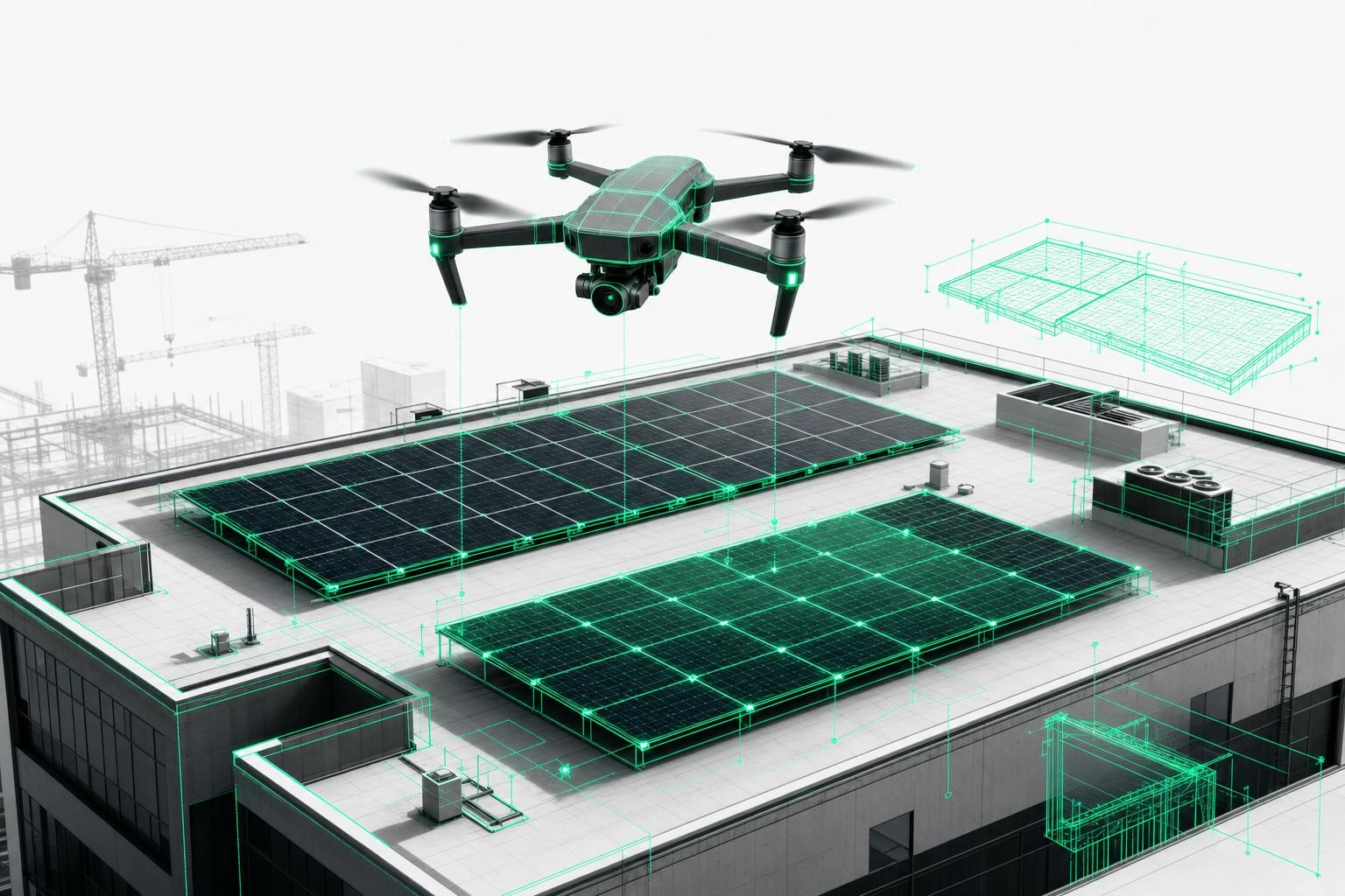
Why Drone-Based Measurement Is Transforming the Trades
The use of drones in roofing is growing steadily. This development is not a short-lived trend, but a direct response to the trade's biggest challenges: time pressure, safety risks, and rising demands for precision.
The limitations of traditional roof measurement
Every roofer and carpenter knows the issue: manual measurement is time-consuming, risky, and prone to error. Traditional surveys often require several hours of climbing ladders, taking measurements, and sketching on site. Despite the effort, inaccuracies are common and frequently lead to costly change orders later on.
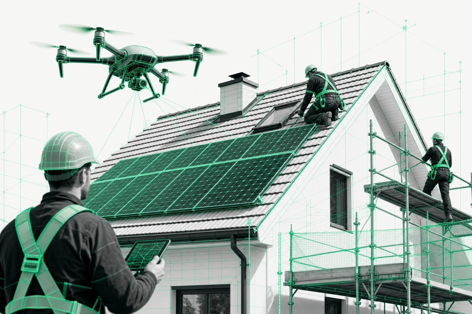
The construction industry records a high number of workplace accidents every year, with roof work among the most hazardous tasks. Modern drone technology virtually eliminates these risks - teams can measure safely from the ground.
Digital revolution: 90% time savings with drone-based measurement
According to figures from Airteam, digital measurements can be carried out up to 90% faster than traditional methods. A short drone flight of 10-15 minutes replaces hours of manual measuring on the roof. The results are not only available much faster, but also precise in line with DIN standards and immediately ready for digital processing.
Concrete advantages for roofers and carpenters:
- Time savings: Up to 90% less effort for measurements and quote preparation
- Safety: No more ladder work - measurement is carried out from the ground
- Precision: Accuracy depending on service level from 1-3 cm up to 15 cm over a 40 m measuring distance
- Digital workflows: Direct export into MF Dach, SEMA, PV*SOL and other software
- Traceability: All measurements are documented and auditable
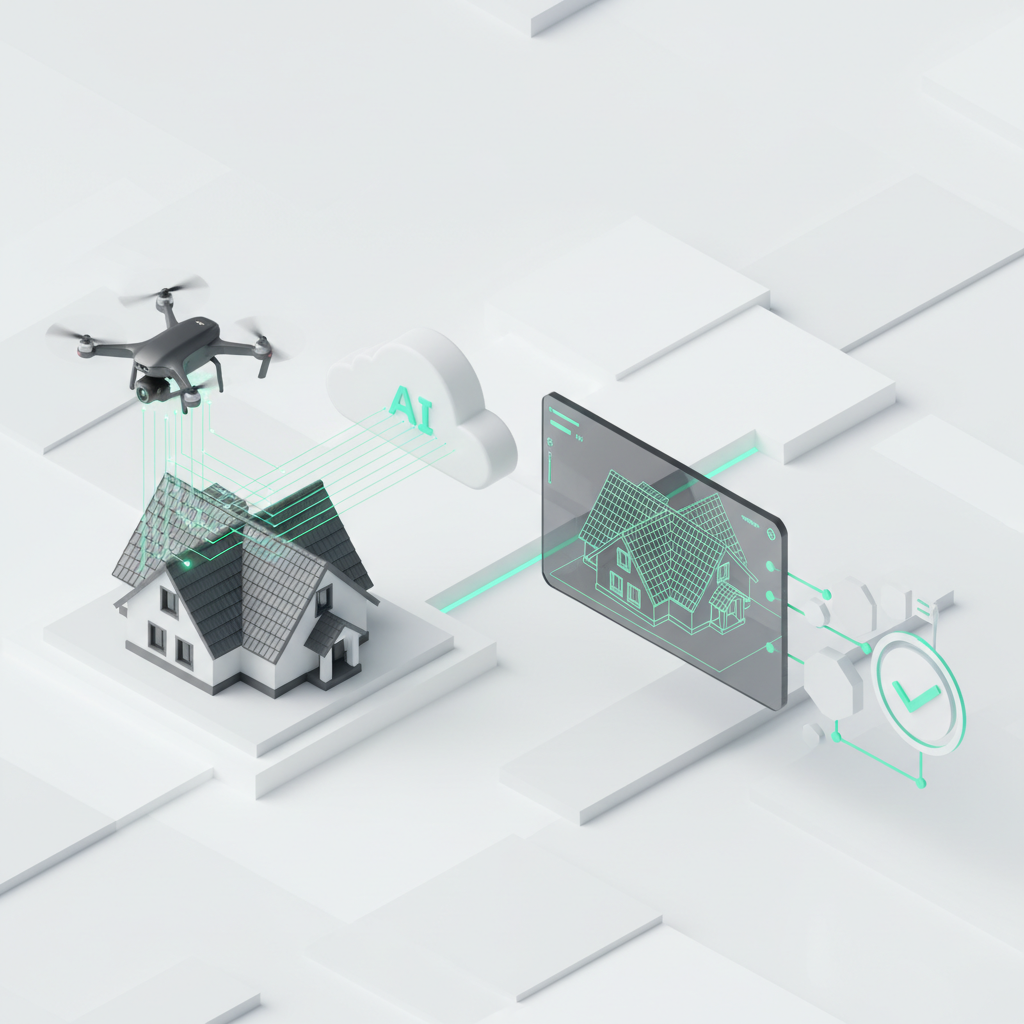
How digital roof measurement with drones works
The process is extremely straightforward: fly, upload, done. In just three steps, drone images are transformed into accurate 3D models and DIN-compliant measurement data.
Step 1: Short drone flight (10-15 minutes)
One single flight captures the entire building. The drone automatically photographs the roof from different angles and creates overlapping images. Modern GPS navigation ensures even coverage and optimal image quality.
Technical requirements:
- Wind speeds up to 30 km/h are acceptable
- No rain or snow during the flight
- Good lighting conditions for best results
- Flight duration: 10-15 minutes per building
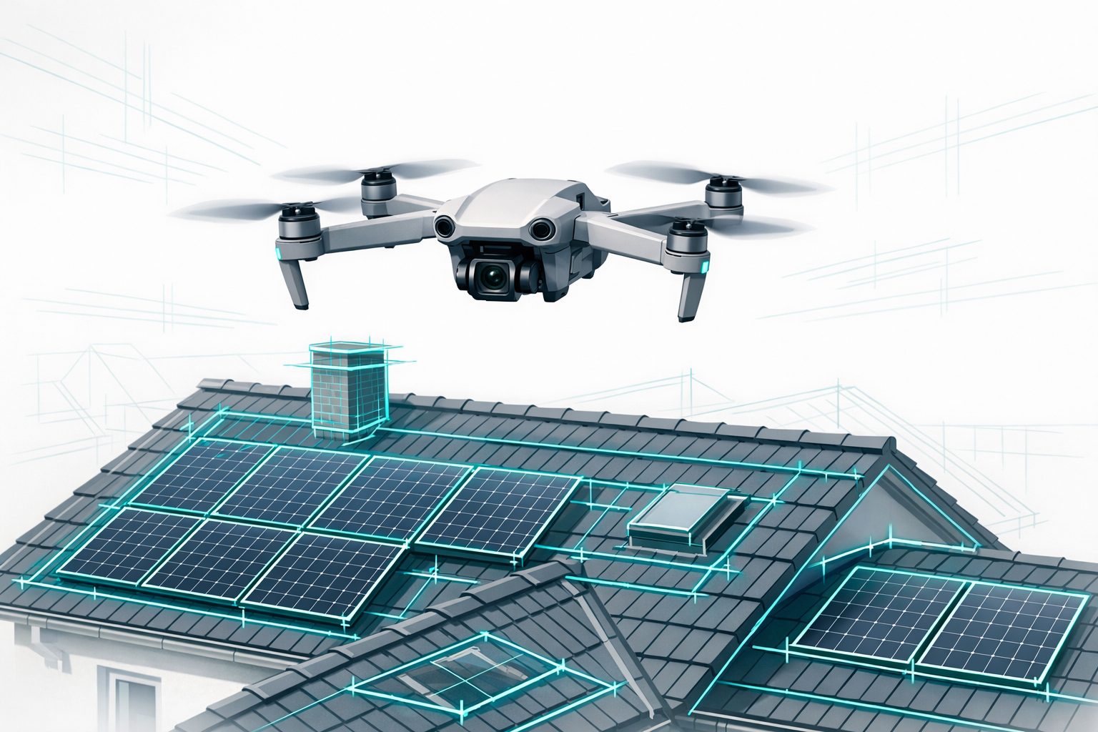
Step 2: AI-powered cloud processing
Once the images are uploaded, artificial intelligence takes over the entire evaluation. Photogrammetry algorithms automatically generate a 3D model with centimeter-level accuracy and detect all relevant roof elements: dormers, valleys, chimneys, roof windows, and shading objects.
The AI process in detail:
- Automatic 3D reconstruction from overlapping drone photos
- Semantic classification of all roof and facade elements
- Accurate area calculation with DIN-compliant precision
- Export generation into more than 15 different file formats
Step 3: Final planning data within 24 hours
The complete 3D model is available after just 24 hours. Detailed planning data and measurement reports follow within 2-7 working days, depending on project size. All data can be accessed via a web browser and integrated directly into existing software workflows.
The three most important application areas in detail
Accurate roof measurements for reliable cost estimates
Measurements that comply with DIN/VOB standards are the foundation of any solid calculation. Drone-based measurement not only delivers the required area and length values, it also provides fully traceable documentation down to the last square meter.
Comparison: Manual vs. drone-based measurement
| Aspect | Manual measurement | Drone-based measurement |
|---|---|---|
| Time required | 4-6 hours per roof | 30 minutes including flight |
| Accuracy | ±5-10 cm (weather-dependent) | ±1-15 cm (depending on service level) |
| Safety | Ladder access required | Measurement from the ground |
| Post-processing | Hand sketches must be digitized | Direct software export |
| Change orders | Frequent due to measurement errors | Minimized thanks to high precision |
Practical benefits for costing and estimating:
- No hidden surprises: All roof details are visible in the 3D model
- Accurate material takeoff: Exact areas for tiles, insulation, and underlayment
- Risk reduction: DIN-compliant measurements dramatically reduce the risk of change orders
- Faster quote generation: CSV export directly into your estimating software
Professional damage documentation and inspections
Precisely documenting storm and hail damage is crucial for insurance claims. Drones capture damage comprehensively and objectively - without your team ever needing to step onto the roof.
Advantages for damage documentation:
- Complete coverage: No missed defects thanks to systematic drone capture
- Objective evidence: High-resolution images and 3D models as proof
- Faster processing: Insurers receive documentation that is immediately usable
- Comparisons over time: Before-and-after documentation as proof of remediation
Regular maintenance inspections also become much more efficient. Large commercial properties or housing associations already rely on systematic drone inspections to identify maintenance needs at an early stage.
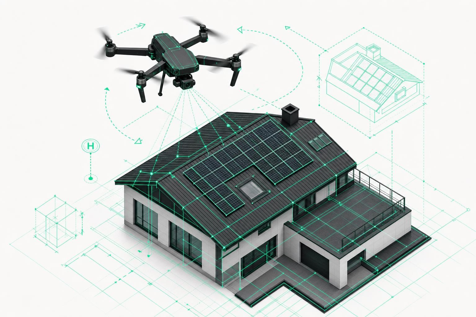
PV system planning from roof survey to installation
The solar photovoltaic sector is one of the biggest growth drivers for drone-based measurement. Accurate roof surveys are essential for optimal module placement and realistic yield forecasts.
PV planning workflow with drones:
- Capture roof geometry: Exact dimensions of all relevant roof surfaces
- Shading analysis: Chimneys, dormers, and neighboring buildings are automatically detected
- Module layout optimization: Maximum coverage with optimal string configuration
- Yield forecast: Realistic kWh calculations based on precise area data
- Installation planning: 3D visualization to brief the installation team
Integration into PV software: Direct data export into established tools such as PV*SOL, SolarEdge Designer, Eturnity, or PVcase. No more manual tracing of roof geometry is required.
Software integration: Seamless workflows for roofers and carpenters
Roofer software integrations
MF Dach, smartDach, and PASST.prime are among the established estimating solutions in the roofing trade. Airteam Fusion supplies measurement data in exactly the formats these programs require.
Practical integration using MF Dach as an example:
- CSV export: Automatic quantity takeoff sorted by trades
- CAD import: DWG/DXF files for detailed planning
- Project structure: Roof areas are already classified by section
- Time savings: From measurement to quote in under 2 hours
Additional supported formats:
- PDF reports: For client presentations and proposals
- Excel lists: For customized calculation methods
- Image material: High-resolution drone photos for documentation
Carpentry software connections
SEMA Software is the leading design solution for timber construction. Integrating drone data into SEMA projects eliminates time-consuming manual measurement and reduces planning errors to an absolute minimum.
SEMA integration in detail:
- Accurate base data: 3D model as the foundation for roof structure design
- Automatic geometry: Eaves, ridges, valleys, and hips are already measured
- CAD export: DWG, DXF, and IFC formats for seamless downstream workflows
- Material planning: Accurate timber lists thanks to precise base data
Additional carpentry integrations:
- SketchUp: 3D models for visualization and client presentations
- AutoCAD: Professional 2D/3D planning data
- Abbund V41: Direct import for automated joinery and cutting plans
- Custom CAD systems: Flexible export formats for all common programs
Seamless connections to PV design tools
The PV sector benefits especially from standardized data handoffs. Airteam supports more than 15 different PV planning tools with native exports.
Key PV integrations:
- PV*SOL: Direct import for yield simulation and shading analysis
- SolarEdge Designer: Module layout with automatic string optimization
- Eturnity: Complete project data for quote generation
- PVcase: Professional planning of large-scale systems
- Sunny Design: SMA inverter design with accurate roof data
Airteam Fusion: The complete solution for the trades
Why Airteam is the ideal solution for roofers and carpenters: The combination of DIN-compliant accuracy, fast turnaround times, and extensive integrations is what makes the real difference.
Technical excellence with DIN compliance
Depending on the service level, Airteam Fusion delivers DIN-compliant accuracy from 1-3 cm (Pro/Max) up to 15 cm (Fast) over a 40 m measuring distance - making measurements legally sound and suitable for all types of calculation. The photogrammetry technology used is 8x more precise than satellite data and meets the requirements of the DIN SPEC.
Technical highlights:
- 24-hour turnaround: 3D model available as early as the next day
- 15+ export formats: For all common trade and planning tools
- Cloud-based: No local software installation required
- Browser-based: Access from any device, anytime, anywhere
Pricing models and ROI calculation
Airteam offers flexible pricing models for companies of every size:
Flat-rate models:
- Fast Fusion: From €150/month - ideal for smaller businesses
- Pro Fusion: Extended features for regular users
- Max Fusion: For high project volumes with priority service
Starter sets with hardware:
- Fast Fusion Set: From €1,950 including drone, training, and a 2-month flat rate
- Pro to Thermal Fusion: Extended packages up to €7,450 for specialized use cases
ROI calculation example for a roofing company (10 projects/month):
- Time savings: 40 h/month (4 h × 10 projects × 90% savings)
- Hourly rate: €65/h -> saving €2,600/month
- Investment: €150/month flat rate -> payback already in the first month
Step-by-step: Getting started with drone-based measurement
Legal basics and the EU drone license
The EU drone license is mandatory for commercial drone flights. Since 2021, harmonized regulations apply throughout Europe to ensure safe drone operations.
Required qualifications:
- A1/A3 certificate: Online test for drones up to 25 kg (free of charge at the German Aviation Authority)
- Insurance: Liability insurance for drone flights (from approximately €80/year)
- Registration: Operator registration with the national aviation authority
Practical checklist for compliant operation:
- ✓ Check flight zones: The DFS DroneRadar app shows permitted areas
- ✓ Maintain visual line of sight: The drone must remain visible at all times
- ✓ Keep distance from people: At least 30 m from uninvolved persons
- ✓ Weather conditions: Wind below 30 km/h, good visibility
- ✓ Documentation: Carry flight log and proof of insurance
Hardware selection: From entry-level to professional sets
Airteam Starter Sets combine proven hardware with professional software and comprehensive training. Each package is ready to use immediately and tailored to specific application areas.
Airteam Starter Sets at a glance:
Fast Fusion (€1,950):
- DJI Mini 3 drone with 4K camera
- 2 months of Airteam Fusion flat rate included
- Online training and support
- Ideal for: Beginners and smaller companies
Pro Fusion:
- Enhanced hardware for more demanding projects
- Longer flight times and higher image quality
- Ideal for: Medium-sized companies with regular demand
Thermal Fusion (€7,450):
- Thermal imaging camera for detecting leaks and supporting energy audits
- Professional hardware for specialized applications
- Ideal for: Energy consultants and renovation specialists
Your first drone flight: A practical guide
Pre-flight preparation - the professional checklist:
Before the flight:
- Check the location: Identify obstacles and restricted airspace
- Check the weather: Wind below 30 km/h, no precipitation
- Charge batteries: Fully charge drone and controller
- Plan the route: Set up the automatic flight in the Airteam app
During the flight:
- Maintain safety distance: Keep 30 m from people and 150 m from residential areas
- Maintain visual contact: Keep the drone in sight at all times
- Observe altitude limits: Do not exceed 120 m above ground level
- Ensure overlap: 70% image overlap for optimal 3D reconstruction
After the flight:
- Check images: Verify complete coverage and image quality
- Start upload: Upload directly via the Airteam Fusion platform
- Update flight log: Record date, location, and flight time
Success stories: How your peers are already benefiting
Roofing company Harnack: 100% accuracy, 0% rework
"Since we started using Airteam, we have not needed a single correction on more than 200 projects," reports managing director Klaus Harnack, according to a customer statement. The 100% accuracy of the measurements has completely eliminated the risk of change orders.
Specific improvements (based on customer statements):
- Time savings: 4 hours saved per project
- Safety: No more ladder-related accidents since implementing drones
- Customer satisfaction: 3D visualizations strengthen proposals and win trust
- Competitive edge: Faster and more accurate quotes than competitors
Roofing company Mann GmbH: 91% time savings, 23% more orders
The numbers speak for themselves (based on customer statements): +91% time savings for measurements and +23% more accepted quotes thanks to professional 3D presentations.
Managing director Heinrich Mann: "The investment paid for itself within 6 weeks. Our teams can finally focus on their trade again while the measurement runs automatically."
Pro Electrify AG: 38% higher close rate
The solar installer Pro Electrify AG uses Airteam for PV system planning and, according to customer information, has increased its project close rate from 45% to 62% (+38%). At the same time, measurement errors were reduced by 92%.
Practical advantages (based on customer statements):
- Client presentations: The 3D roof model immediately convinces homeowners during site visits
- Planning reliability: No more unexpected issues during installation
- Yield forecasts: Accurate kWh calculations thanks to precise shading analysis
ROI calculation: When the investment pays off
Cost comparison: Different measurement approaches
Investment in drone technology pays off even with a small number of projects per month. The key factor is not only time saved, but also improved project quality and better safety.
Cost comparison per roof measurement:
| Method | Time required | Labor costs | Additional costs | Total costs |
|---|---|---|---|---|
| Manual | 4-6 hours | €260-390 | Insurance, accident risk | €300-450 |
| Pilot service | 1 hour | €65 | Service €150-250 | €215-315 |
| Own drone | 0.5 hours | €32.50 | Airteam €15-25 | €47.50-57.50 |
Payback calculation for different company sizes:
Small company (5 projects/month):
- Savings: 20 h × €65/h = €1,300/month
- Investment: €150/month flat rate + €1,950 starter set
- Payback period: 2-3 months
Medium-sized company (15 projects/month):
- Savings: 60 h × €65/h = €3,900/month
- Investment: €292/month Pro flat rate + hardware
- Payback period: Around 1 month
Large company (30+ projects/month):
- Savings: 120 h × €65/h = €7,800/month
- Investment: €1,000/month Max flat rate
- Payback period: Immediate profitability
Hidden advantages of drone-based measurement
Beyond pure time savings, there are additional economic benefits:
Reduced change orders:
- Problem: Manual measurements are error-prone and often lead to costly renegotiations
- Solution: DIN-compliant drone surveys reduce planning risk by up to 95%
- Savings: €500-2,000 per avoided change order
Higher project close rate:
- Problem: Hand-drawn sketches look unprofessional
- Solution: 3D visualizations prove your expertise to clients
- Added value: 15-30% higher close rate thanks to professional presentations
Improved occupational safety:
- Problem: Ladder work causes accidents and drives up insurance costs
- Solution: Drone-based measurement eliminates dangerous roof climbs
- Savings: Lower insurance premiums and reduced downtime
FAQ: Frequently asked questions about drone-based measurement
What weather conditions are required for drone flights?
Drone flights are possible in most weather conditions. Wind up to 30 km/h is usually not a problem; only rain, snow, or very poor visibility prevent safe flights. Optimal results are achieved under overcast skies without harsh shadows - strong, direct sunlight can cause overexposure. Most projects can easily be carried out all year round.
How accurate are drone measurements really?
Depending on the service level, Airteam Fusion achieves different levels of accuracy: Fast Fusion around 15 cm, Pro Fusion around 10 cm, and higher service levels down to 1-3 cm over a 40 m measuring distance. This meets the requirements for VOB-compliant measurements and is 8x more precise than satellite data. In practice, this accuracy surpasses manual measurements, which often deviate by 5-10 cm depending on weather conditions. All measurements are fully documented and can be used as legally compliant evidence.
What software integrations are available?
Airteam supports more than 15 export formats for seamless workflow integration. Roofers benefit from direct exports into MF Dach, smartDach, and PASST.prime. Carpenters use SEMA, SketchUp, and AutoCAD integrations. PV designers work with PV*SOL, SolarEdge Designer, Eturnity, and PVcase. CSV, DWG, DXF, and IFC formats enable integration into virtually any estimating or planning software.
What does a measurement cost per project?
Project costs depend on the chosen pricing model. Flat-rate users pay from €150 per month for unlimited measurements. For pay-per-project billing, costs range from €15-50 per building, depending on size and complexity. The "one-building-one-credit" system keeps costs predictable. Facade measurements require 4 credits, roof surveys only 1 credit per building.
How quickly will I receive the measurement results?
The 3D model is available after just 24 hours. Detailed planning data and measurement reports follow within 2-7 working days, depending on project size and selected service level. For urgent projects, Airteam offers an express service with accelerated processing. The browser-based platform provides instant access to all results from any device.
Outlook: The future of digital construction site measurement
The digitalization of the skilled trades is only just beginning. AI-powered technologies will continue to increase the precision and speed of drone-based measurement, while new sensors will unlock additional analysis options.
Emerging technology trends
Thermography integration already enables the combination of measurement and energy consulting today. Thermal imaging cameras reveal thermal bridges and leaks - a growing market in energy-efficient retrofits.
LiDAR sensors will make drone-based measurement even more precise and deliver reliable results even in poor lighting conditions. The technology is already available and will become more affordable over the next few years.
Automated damage detection using AI will revolutionize insurance claims processing. Algorithms already identify hail damage, cracks, and missing tiles automatically and estimate the repair effort.
The trades go digital
The use of drones in the trades is growing steadily - and the trend is sharply upward. Those who still measure manually today are increasingly falling behind the curve of digital transformation. Clients expect professional 3D presentations and accurate cost estimates.
The integration of drone data into ERP systems and the connection with IoT sensors for continuous building monitoring will be the next stages of development. The role of the trade is evolving from reactive repair contractor to proactive building manager.
Conclusion: Drone technology is no longer just a competitive advantage - it is becoming a basic requirement for future-proof trade businesses. Now is the right time to get started: the technology is mature, the costs are manageable, and the ROI is typically achieved within just a few weeks.
Sources & facts
[S1] DDH.de - Airteam: Digital roof measurement 4.0 (2022): https://www.ddh.de/airteam-digitale-dachvermessung-4-0-02022022
[S2] Airteam.ai - Guide to roof measurement with drones: https://www.airteam.ai/en/blog/ratgeber-dachaufmass-drohnen-vermessung
[S3] Drohnenvermessung.digital - Software information: https://www.drohnenvermessung.digital/unsere-software
[S4] SEMA Software GmbH - Official website: https://www.sema-soft.com/
[S5] Haufe.de - Accident hazards on construction sites (2019): https://www.haufe.de/arbeitsschutz/sicherheit/das-sind-die-groessten-unfallgefahren-auf-baustellen_96_526020.html
[S6] Wikipedia - SEMA CAD software: https://de.wikipedia.org/wiki/SEMA_CAD-Software
Note: All prices are non-binding and valid as of 2025. Please contact Airteam directly for current conditions. Customer statements and success stories are based on information provided by the manufacturer.