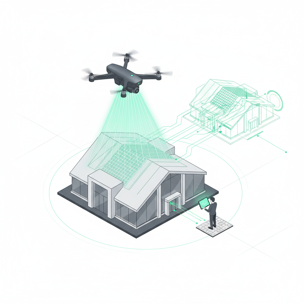
The direct answer: A professional roof survey with a drone takes less than 5 minutes of flight time and automatically delivers a standards-compliant 3D model with high accuracy. The process is up to 90% faster than traditional methods and completely eliminates fall risk. Modern photogrammetry software such as the Airteam Fusion platform generates a full digital roof survey from the drone images within 24 hours, which you can export straight into your estimating software. No CAD skills required.
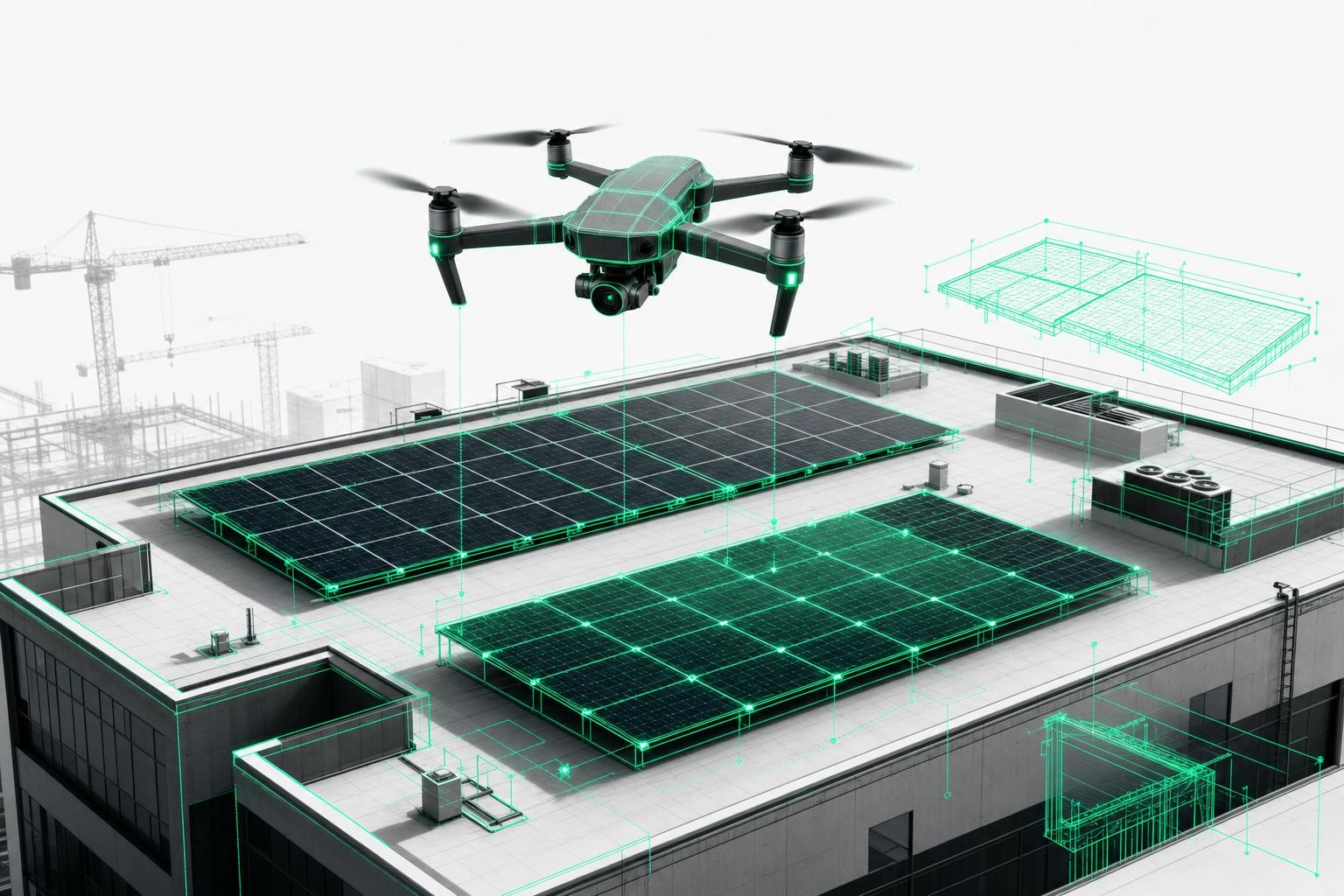
The digital transformation of the construction industry has reached roofing as well. Where hours of risky climbing on steep roofs used to be part of everyday work, drones are now revolutionizing how roofers, carpenters, and solar installers capture their measurements.
Why drone-based roof measurement is the future
Advantages over traditional methods
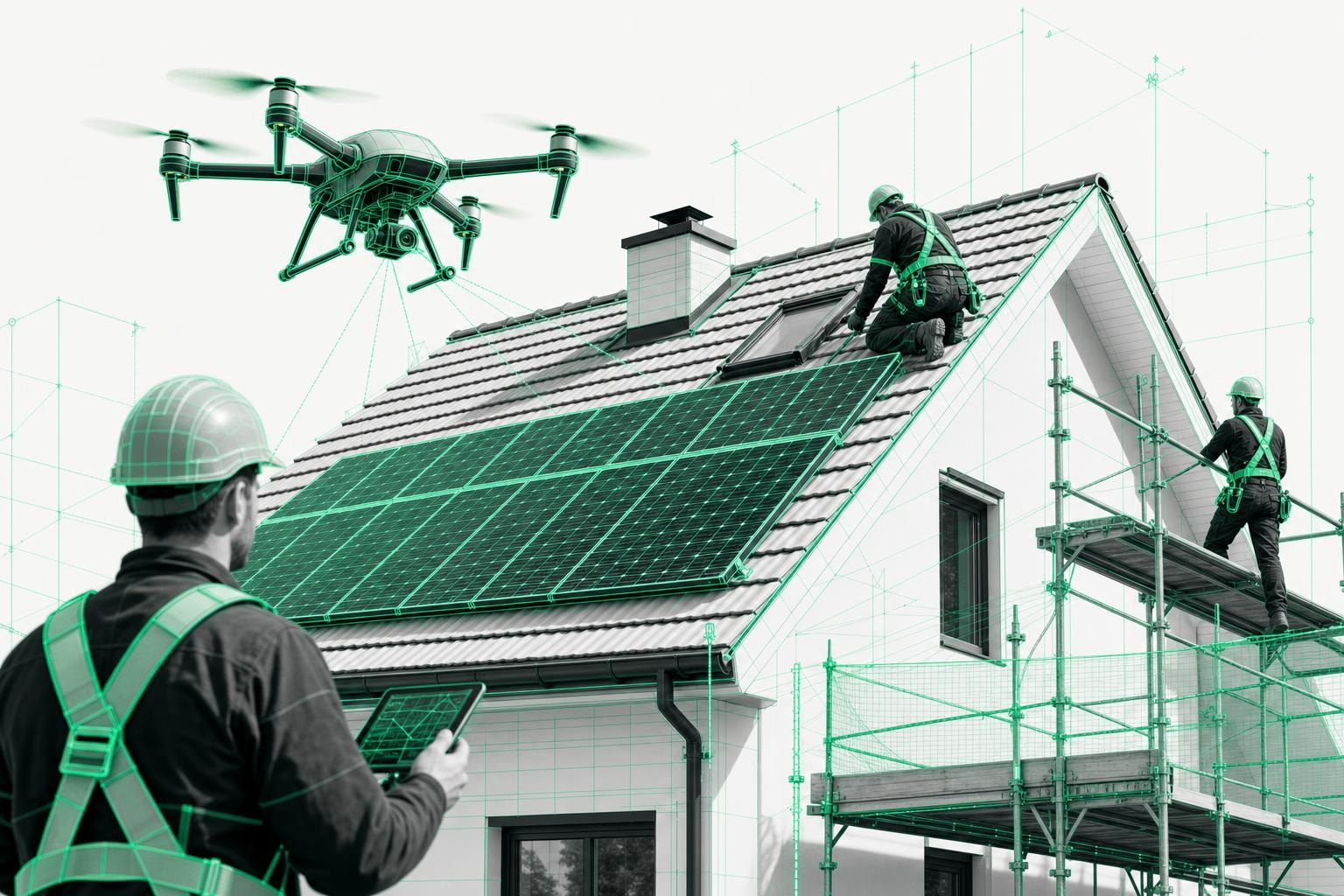
Safety first: Falls account for 80-84% of all workplace accidents in the roofing sector. With drone surveying, you stay safely on the ground. According to Airteam, none of their more than 5,000 customers has had a workplace accident during roof measurement since switching to drone surveys.
Unmatched speed: Save up to 90% of the time compared to manual measurements. What once took hours or even days can now be completed in 45 minutes - including data capture and evaluation.
High-level precision: Studies show that automated drone solutions achieve average accuracy of 99.4%. According to Airteam, their RTK system reaches up to 99.9% accuracy with tolerances of just 1-3 cm over a distance of 40 meters. Actual accuracy can vary depending on conditions and equipment.
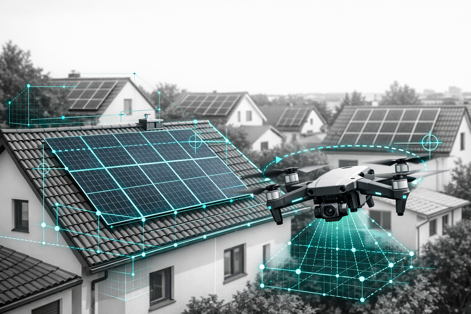
Less dependent on the weather: Measurements are possible in wind speeds up to 30 km/h - in virtually any conditions except heavy rain or thunderstorms.
A rapidly growing market
Drone technology is seeing ever wider use in the roofing trade - and the investment pays off quickly. Thanks to the massive time savings and the removal of fall risk, a professional drone solution often pays for itself after just a few projects.
According to Airteam, more than 5,000 trades businesses already use their technology for roof measurement. The company reports that over 70,000 projects have been successfully completed - with consistently high accuracy and customer satisfaction.
Step-by-step guide: measuring a roof with a drone
Step 1 - Preparation and mission planning
Clarify legal requirements: Obtain a drone registration plate, take out liability insurance, and secure flight permissions for built-up areas where required. Airteam supports you throughout the permitting process.
Plan the flight path strategically: Take into account roof size, surrounding obstacles such as trees or power lines, and current weather conditions. Calm, overcast days are ideal for even lighting.
Run an equipment check: Fully charge the drone battery, format the memory card, and prepare spare batteries. Mark off safety zones around the take-off position and inform bystanders.
Choose your weather window: Wind speed below 30 km/h, no precipitation or thunderstorms. You will achieve the best results under overcast skies without harsh shadows.
Step 2 - Equipment and technical requirements
Choose the right drone: At least 20 MP camera resolution for detailed imagery. In exceptional cases, 12 MP can be sufficient, but with compromises in detail accuracy.
RTK technology for maximum precision: RTK drones (Real Time Kinematic) provide centimeter-level positioning through real-time corrections - essential for measurements that comply with industry standards.
Airteam Starter Sets - complete solutions: From Fast Fusion to Thermal Fusion, you receive hardware, training, and software access from a single provider, according to Airteam. Starter Sets start at €1,950 and include a 2-month flat-rate subscription, based on the provider's information.
Professional accessories: Spare batteries, propeller guards, a transport case, and a tablet for flight control. Quality-conscious contractors rely on proven brand hardware with service support.
Step 3 - Conducting the survey flight
Program automated flight patterns: Modern drone apps automatically generate optimal flight routes with 80% image overlap in all directions. This redundancy is crucial for high-quality 3D models.
Make the most of flight time: A typical survey flight takes less than 5 minutes per roof. In that time, the drone captures 50-200 high-resolution photos from different angles and altitudes.
Monitor image quality live: Check sharpness and overlap while the drone is in the air. This helps you avoid repeat flights and saves valuable time.
Follow safety protocols: Maintain visual line of sight to the drone, keep an eye on the airspace, and land immediately if issues occur. Most modern drones automatically return to the take-off point if they lose signal.
Do not skip documentation: Take additional photos of the take-off position and any special roof details. These reference images are useful later for quality control and client consultations.
Step 4 - Data processing and 3D model creation
Upload to the cloud platform: According to the manufacturer, the Airteam Fusion platform processes your drone images fully automatically. Simply upload, let the AI do its work, and you are done.
Understand the photogrammetric process: The software analyses overlapping images using stereoscopic evaluation. Differences in parallax are used to derive precise height and depth information.
AI-powered object detection: Modern algorithms automatically identify roof surfaces, dormers, valleys, chimneys, and other roof features. This significantly reduces manual post-processing.
Plan for turnaround times: The 3D model is available after 24 hours, with detailed planning data following after 2-7 business days depending on project size. An express service is available for urgent projects.
Step 5 - Analysis and export of measurement data
Measure directly in the 3D model: Click distances, areas, and volumes directly in the browser-based 3D viewer. All dimensions comply with established construction standards and are clearly documented.
Export to 15+ formats: Seamless integration with MF Dach, PV*SOL, Eturnity, SketchUp, AutoCAD, and other industry software. One click is all it takes for a perfect data export.
Generate survey reports: Automatically generated, standards-compliant reports including all relevant dimensions, areas, and quality confirmations. Legally robust documentation for VOB-based billing.
Built-in quality control: Every model undergoes automatic plausibility checks. Any inconsistencies are highlighted and can be corrected before use.
Use customer visualizations: Impress your clients with photorealistic 3D views of their roof. Professional presentations lead to significantly higher close rates.
Costs and profitability of drone-based roof measurement
Investment made simple
Airteam pricing models at a glance: According to the provider, Starter Sets for beginners start at €1,950, with flat-rate plans from €125 per month for regular users. The investment often pays for itself after only 10-15 projects.
ROI calculation example: With 90% time savings and an hourly rate of €65, you save 4-6 hours per roof survey = €260-390. With just 5 projects per month, that equals €1,300-1,950 in saved labor time. These calculations are examples and may vary depending on individual circumstances.
Avoid hidden costs: Factor in reduced healthcare insurance costs due to fewer workplace accidents, lower liability premiums, and fewer sick days.
In-house vs. service provider - what pays off?
Fly yourself when demand is regular: From around 10 or more projects per month, owning your own drone and software subscription usually makes financial sense. You keep full control over scheduling and data quality.
Airteam pilot network for occasional users: Cover one-off projects or peak workloads flexibly through the pilot network. No fixed costs, yet professional quality.
The optimal hybrid solution: Many successful businesses combine both approaches - basic in-house equipment plus external pilots when capacity is tight.
Legal framework and permissions
Compliance from day one
Apply for drone registration: Since 2021 this has been mandatory for all drones over 250 g. In Germany you can obtain it online from the Luftfahrt-Bundesamt for €25, valid for 5 years.
Take out insurance: At least €1 million coverage for commercial drone operations. Many insurers offer special policies tailored to trades and contractors.
Flight permissions in built-up areas: Required for flight altitudes over 100 m or in controlled airspace. Allow 4-8 weeks for processing.
Observe data protection: Avoid capturing neighboring properties and people in an identifiable way. Ensure General Data Protection Regulation (GDPR)-compliant data processing when using cloud services.
Understand the EU drone regulation: Categories Open/Specific/Certified, CE marking, remote pilot certificate - Airteam provides comprehensive advice on all requirements.
Use cases for drone-based roof surveys
For roofers and carpenters
Speed up quotation work: Calculate exact material requirements even before a full site visit. Fewer recalculations and higher profit margins thanks to precise quantity determination.
Document construction progress: Regular drone flights show project development transparently. Ideal for communication with building owners and for billing based on VOB/C.
Standards-compliant measurement: All dimensions comply with official building standards. Legally secure for tenders, invoicing, and warranty claims.
For solar installers
Optimize module layout: Accurately determine optimal module count and total system output. Perform shading analysis and string design directly in the 3D model.
Seamless software integration: Direct export into PV*SOL, Eturnity, SolarEdge Designer, and other planning tools. One click takes you from 3D model to final system layout.
Make customer consultations more professional: Impress prospects with photorealistic visualizations of their future PV system. Higher close rates are virtually guaranteed.
For insurers and surveyors
Reinvent damage assessment: After storms or hail, inspect multiple buildings per day using a drone. Rapid claims settlement with no risk to surveyors.
Improve documentation: Complete photographic and measurement documentation as evidence for insurance claims. 3D models display damage in more detail than ever before.
Significant cost savings: Fewer on-site surveyor visits, shorter processing times, and happier customers thanks to faster settlements.
FAQ - Frequently asked questions about drone-based roof measurement
How accurate are drone measurements really?
Studies show that automated drone solutions achieve average accuracy of 99.4%. According to manufacturers, modern RTK drones can even reach up to 99.9% accuracy with tolerances of just 1-3 cm over 40 meters. Actual accuracy depends on conditions and equipment.
In what weather conditions can I fly?
Drone flights are possible up to wind speeds of 30 km/h. Not suitable: heavy rain, snowfall, thunderstorms, or fog below 150 m altitude. Optimal conditions: overcast and calm.
How long does a complete roof survey take?
On-site data capture: less than 5 minutes of flight time. 3D model available after 24 hours, detailed planning data after 2-7 business days depending on project complexity.
How much does professional drone surveying cost?
According to Airteam, Starter Sets begin at €1,950 including hardware and a 2-month subscription. Flat-rate plans from €125 per month. Individual projects via the pilot network from €200-500 depending on roof size.
Do I need a special drone for surveying?
A minimum of 20 MP camera resolution is recommended, with RTK equipment for maximum accuracy. Proven models include DJI Mavic 3 Enterprise RTK, Phantom 4 RTK, or comparable systems.
How difficult is the software to use?
According to Airteam, the Fusion platform runs in the browser - no installation required. Intuitive operation with no need for CAD knowledge. Automatic AI evaluation handles about 90% of the workload.
What legal hurdles are there?
You need to comply with the EU drone regulation, register your drone, obtain insurance, and in some areas secure flight permissions. Airteam provides comprehensive support with all legal questions.
Airteam - your partner for professional roof surveys
Why Airteam is the first choice for tradespeople
Market leader with experience: As one of the best-known companies in the German-speaking market for drone-based roof measurement, more than 5,000 trades businesses reportedly rely on Airteam technology.
Standards-compliant AI pipeline: Automated analysis with high accuracy using algorithms developed specifically for the construction trades. Every model undergoes quality control in line with DIN SPEC 5452-5.
End-to-end service from a single source: Hardware starter sets, pilot training, software access, and support - everything is perfectly coordinated for maximum success.
Lightning-fast delivery: 3D models within 24 hours, even at high project volumes. Express service available for urgent jobs.
Success stories from the field
Dachdeckerei Harnack reports: "100% accuracy with 0% rework since switching to Airteam. Our calculations are finally accurate down to the last square meter."
According to Airteam, Gewobag achieved: 70-80% time savings in building data capture and 40% cost savings in preliminary assessments for renovation projects.
According to Airteam, Svea Solar achieved: 48% less planning time, 15% higher energy yields thanks to optimized layouts, and 25% lower project costs through precise calculations.
These successes show what is possible when traditional craftsmanship meets state-of-the-art technology.
Conclusion: Get started now with professional drone-based roof measurement
The advantages speak for themselves
90% time savings compared to traditional measurement, complete elimination of fall risk, and high accuracy thanks to modern technology - drone measurement is no longer a thing of the future but the present for successful trades businesses.
Seamless integration with MF Dach, PV*SOL, and other industry software makes switching easy. No CAD skills required - the AI automatically handles the complex analysis.
Drone technology is rapidly becoming standard in the roofing industry - will you be among the pioneers or the late adopters? The technology is mature, the pricing is fair, and the support is first class.
Take off now with Airteam
Contact the Airteam team today for a free consultation on the best Starter Set for your needs. Or book your first pilot directly for a test project. The future of roof measurement begins with your first drone flight.
Sources & facts overview:
[S1] Airteam Blog - Roof measurement with drones: everything you need to know (2025): https://www.airteam.ai/en/blog/roof-measurement-with-drones-everything-you-need-to-know
[S2] Airteam Blog - Drone surveying vs. manual roof measurement: the ultimate comparison (2025): https://www.airteam.ai/en/blog/drohnenvermessung-vs-manuelle-dachvermessung-vergleich-2025
[S3] Airteam Blog - Roof survey guide: drone measurement (2025): https://www.airteam.ai/en/blog/ratgeber-dachaufmass-drohnen-vermessung
[S4] Roofing Contractor Magazine - Bureau of Labor Statistics (2024): https://www.roofingcontractor.com/articles/99010-roofing-has-second-highest-workplace-fatality-rate-in-the-us
[S5] handwerk-digital.nrw - New technologies: drones (2024): https://handwerk-digital.nrw/schwerpunkte/neue-technologien/drohnen/
[S6] dach.live - Roofers develop drone guidelines for measurement (2024): https://dach.live/innovation-technik/trends/dachdecker-entwickeln-drohnen-richtlinie-fuer-aufmass/
[S7] Airteam Website - Pricing (2025): https://www.airteam.ai/en