Image for the current article

Drone services are transforming the surveying and inspection industry in Germany. The German drone market reached a value of 893 million euros in 2023, making it the fourth largest commercial drone market worldwide. But what does a professional drone service actually cost?

The cost of drone services varies significantly depending on the use case, project size, and required accuracy. While drone inspections offer substantial cost savings compared with manual methods, final prices depend on several factors: the type of data capture system, the size of the area, the complexity of data processing, and the deliverables you expect.

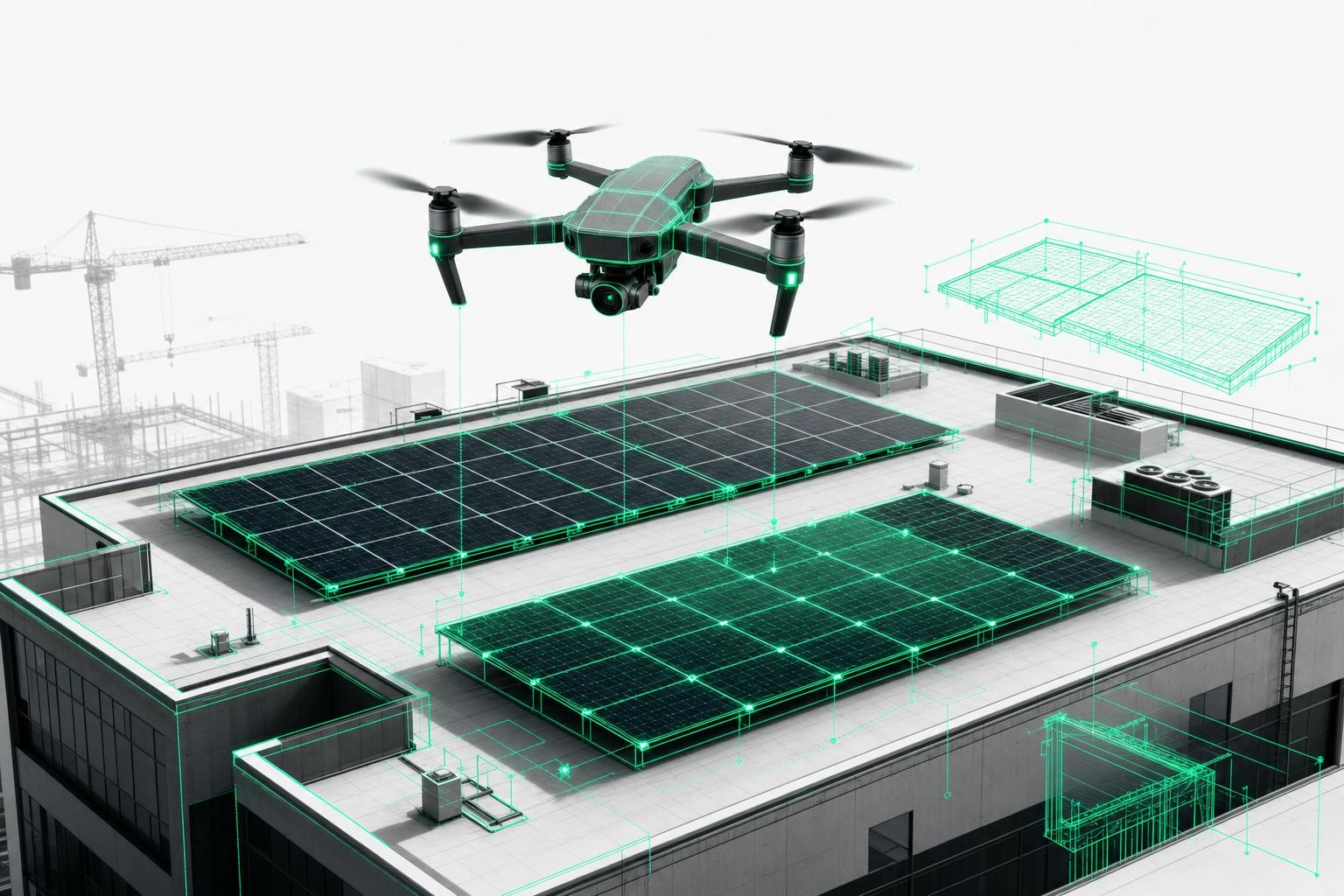
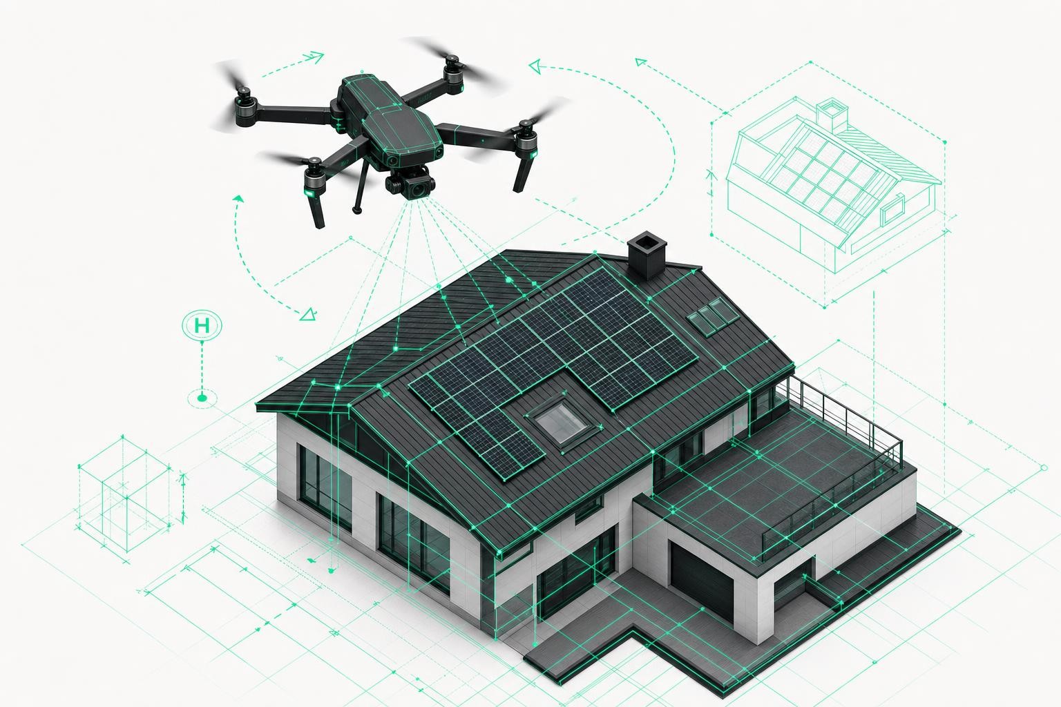
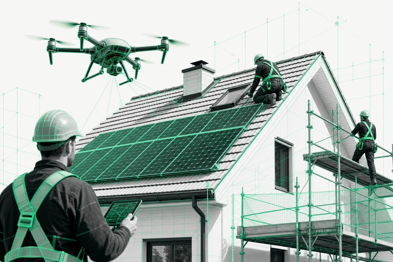
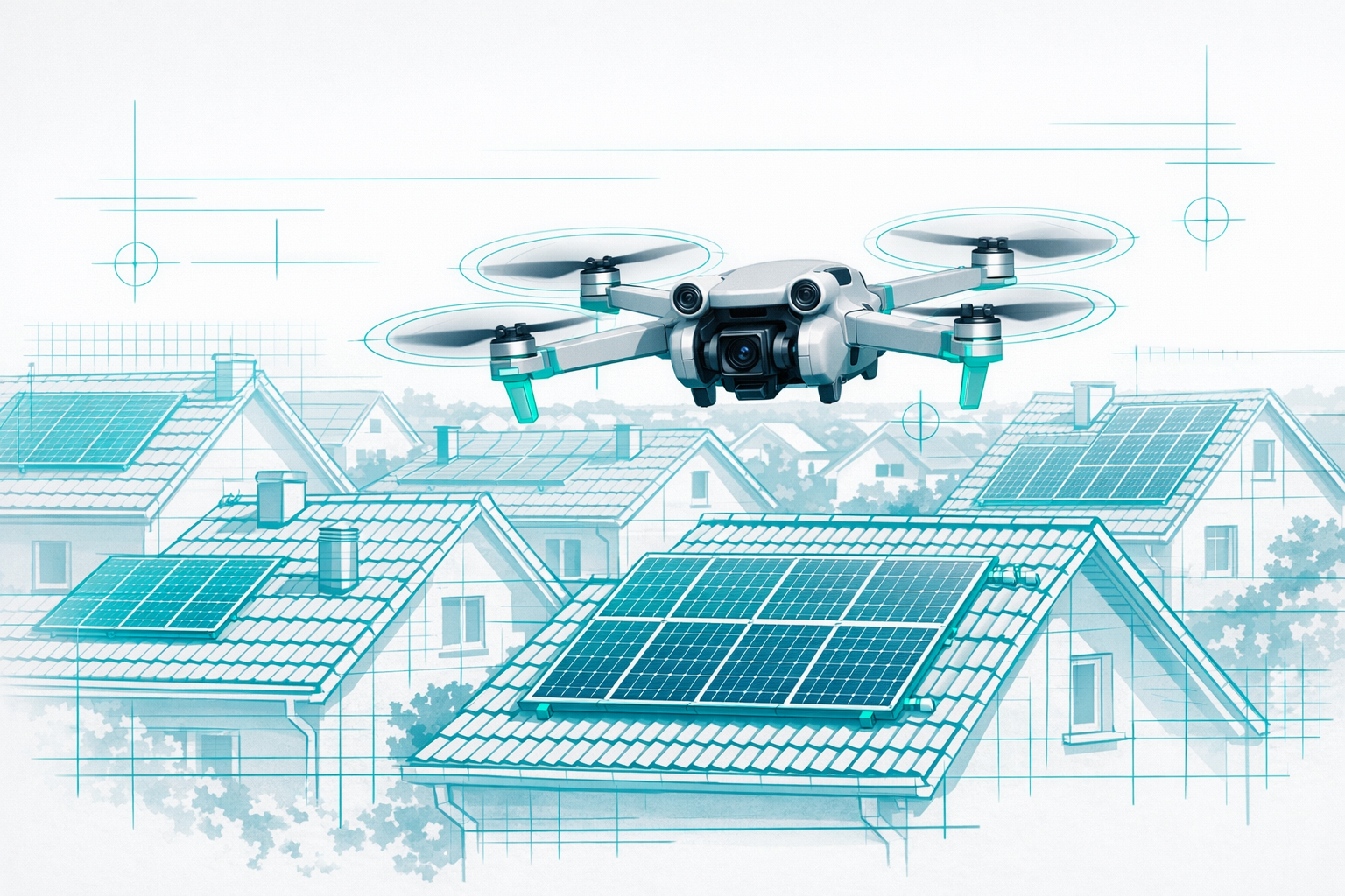
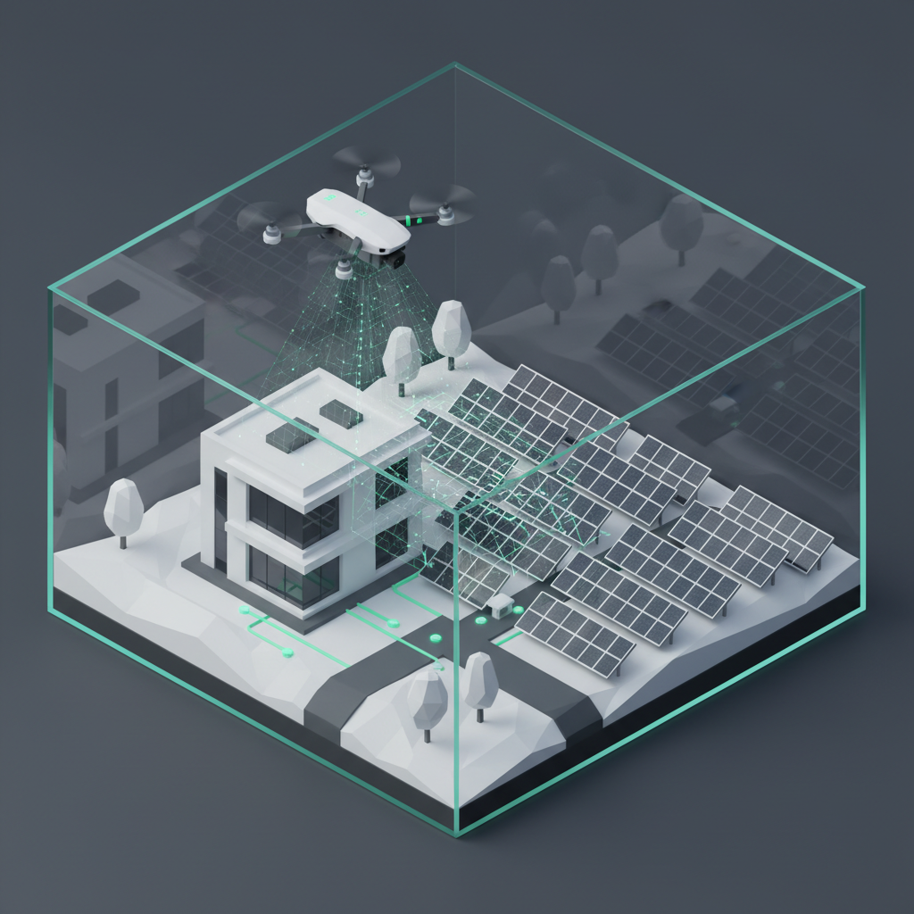
For trades and construction companies in particular, drones provide a DIN-compliant alternative to risky roof access - with precise measurements captured safely from the ground.

Price Drivers for Drone Services

Key Cost Factors at a Glance

The cost of drone imaging can vary widely - the type of data collected, the drone technology used, and the duration and number of flights all determine the final price.

The most important cost factors are:

  • Type of service: 3D surveying requires different sensors and post-processing than thermal inspections
  • Area size: Larger sites mean longer flight times and more image data
  • Accuracy requirements: RTK-enabled drones with centimeter-level accuracy are more expensive than standard GPS systems
  • Object complexity: Intricate roofs or facades with many details increase effort
  • Post-processing: DIN-compliant survey reports or detailed 3D models require specialized software and expertise

Hidden Costs That Are Often Overlooked

In Germany, the biggest cost drivers are weather-related delays and required permits. Especially in controlled airspace, approval processes can significantly delay project start.

Additional hidden costs include:

  • Travel costs: Can vary considerably depending on the distance to the project site
  • Permitting processes: Official approvals in sensitive areas
  • Weather-related delays: Drone flights depend on weather and may need to be rescheduled multiple times
  • Insurance and certification: Professional providers must carry appropriate coverage
  • Reflights: Additional flights if the initial mission did not capture everything needed

3D Surveying With Drones - Costs and Services

Pricing for 3D Surveys

Drone surveying providers charge different prices depending on project size and complexity, with costs influenced by several factors. Simple residential buildings fall in the lower price range, while large commercial projects are priced significantly higher.

Pricing is usually project-based and takes into account:

  • Building size and complexity: Single-family house vs. commercial complex
  • Required output formats: Basic 3D models vs. DIN-compliant survey reports
  • Turnaround time: Standard 24-48 hours vs. express service
  • Additional services: CAD export, quantity takeoff, planning documentation

What Is Included in the Cost?

RTK drones achieve an accuracy of 1-3 cm and enable the creation of precise, georeferenced 2D maps and detailed 3D models for exact length, area, and volume measurements.

Standard service packages typically include:

  • On-site drone flight: Capture of all relevant building elements
  • Automated 3D modeling: Photogrammetric processing of the image data
  • Basic measurements: Areas, lengths, and volumes directly in the 3D model
  • Web-based access: Browser-based viewing for all project stakeholders
  • Standard exports: Common file formats for further processing

Accuracy and Standards

RTK drones can deliver 1-3 cm precision under optimal conditions. This centimeter-level accuracy meets professional standards and enables DIN-compliant survey reports for commercial applications.

Quality criteria for professional 3D surveying:

  • RTK technology: Real Time Kinematic for maximum accuracy
  • DIN compliance: Survey reports meet recognized German standards
  • Reference points: Ground control points for absolute accuracy
  • Documentation: Traceable measurement processes and quality control

Solar Panel Inspection by Drone - Pricing and Added Value

Costs for PV System Thermography

Thermal drone inspections can cover up to one megawatt in about 10 minutes, while manual I-V curve measurements take 2-5 hours per megawatt. This makes drone inspections a far more efficient option for monitoring solar installations.

Pricing structures for PV inspections vary based on:

  • System size: Small rooftop systems vs. ground-mounted plants
  • Scope of inspection: Pure thermography vs. detailed damage analysis
  • Depth of reporting: Simple documentation vs. in-depth fault analysis
  • Urgency: Standard turnaround vs. express service

Ground-Mounted Plants vs. Rooftop Systems

Large photovoltaic plants are typically billed at daily rates, while smaller rooftop systems are often offered as fixed-price packages. Evaluation is usually billed by the hour so clients only pay for the actual analysis effort.

Different pricing models:

  • Small rooftop systems (up to 30 kWp): Fixed-price packages with full service
  • Commercial systems (30-100 kWp): Hybrid pricing models depending on complexity
  • Ground-mounted plants (100+ kWp): Daily rates plus hourly evaluation
  • Portfolio inspections: Special terms for multiple sites

ROI and Time Savings

Regular inspections pay for themselves quickly by preventing performance losses. Without systematic monitoring, PV systems can suffer significant yield losses that soon exceed inspection costs.

Economic benefits:

  • Early detection: Identify defective modules before total failure
  • Documentation: Evidence for insurance and warranty claims
  • Planned maintenance: Efficient repair scheduling instead of emergency callouts
  • Yield protection: Maximize system output through regular checks

Example Cost Breakdowns by Use Case

Single-Family Home 3D Survey

A typical single-family home with around 150 m² of roof area can usually be captured in a single morning and delivered as a precise 3D model within 24-48 hours.

Cost breakdown for a standard project:

  • Drone flight: 1-2 hours on site including preparation
  • Data processing: Automated 3D modeling
  • Basic evaluation: Area and length measurements
  • Web access: 12 months of access to the 3D model
  • Standard exports: PDF report, DXF floor plan

Commercial Property Full Scan

Larger assets with both roof and facade surveying require more complex flight planning and significantly more post-processing. Complexity increases disproportionately with building size.

Enterprise projects typically include:

  • Multi-day capture: Complex flight planning for complete coverage
  • High-resolution sensors: Specialized camera systems for maximum detail
  • CAD integration: Direct exports into planning software
  • Project management: Dedicated point of contact and scheduling

Solar Park Thermographic Inspection

Ground-mounted solar plants of various sizes benefit particularly from the speed of drone-based inspections. Large parks can be checked systematically and comprehensively in a fraction of the time required for manual methods.

Cost model for solar parks:

  • Small parks (1-5 MW): Daily flat rate plus evaluation
  • Medium parks (5-20 MW): Multi-day campaigns with specialized equipment
  • Large parks (20+ MW): Long-term service contracts with regular inspections
  • Emergency inspections: Express service for acute issues

Regional Price Differences and Provider Comparison

Price Comparison Within Germany

Prices can vary significantly depending on the distance to the nearest provider location. Urban areas with many providers often show more competitive pricing than rural regions with fewer service companies.

Regional factors:

  • Provider density: Greater competition in major cities
  • Travel distances: Rural projects with higher travel costs
  • Local regulation: Different permitting procedures in each federal state
  • Market maturity: Established vs. emerging markets with differing price levels

Quality Criteria for Reliable Providers

Experienced and well-trained drone pilots charge higher fees but deliver better results and greater safety. When choosing a provider, you should consider not only price but also qualifications and references.

Checklist for professional providers:

  • Certifications: EU drone license and commercial approvals
  • Insurance: Adequate liability coverage for commercial projects
  • References: Proven experience in the relevant industry
  • Technology: Modern RTK-capable drones and professional software
  • Compliance: DIN-compliant workflows and traceable processes

FAQ - Common Questions About Drone Services

How much does a 3D drone survey cost?

Drone surveying providers charge different prices depending on project size and complexity, with object size and required accuracy being the main drivers. Drone surveying is significantly more economical than traditional terrestrial surveying and delivers comparable, DIN-compliant results at much lower cost.

How expensive is a solar panel inspection by drone?

Thermal drone inspections can be completed in about 10 minutes per megawatt compared with 2-5 hours for manual I-V curve measurements. Drones enable cost-effective and efficient inspection of large numbers of modules in a very short time with precise damage documentation.

Which factors have the biggest impact on prices?

The largest cost drivers in Germany are weather-related delays and required permits. Flight time, number of images, and the complexity of post-processing all have a major impact on total cost. Travel distance, use of RTK technology, and the level of DIN compliance required also influence pricing.

Is it worth using a drone compared with conventional methods?

Drones are significantly faster than traditional surveying methods and offer substantial cost savings for inspections. They enable major time savings thanks to reduced labor, shorter project durations, and minimized safety risks. The investment pays off through higher efficiency and better result quality.

Are the measurement results legally recognized?

RTK drones achieve 1-3 cm precision and can generate DIN-compliant survey reports. Certified roof and facade survey reports meet professional standards and are legally usable. The results fulfill commercial requirements and can be used for official documentation.

Conclusion and Practical Recommendations

Drone surveying offers a cost-effective way to capture precise data for a wide range of applications, from roof surveys to solar park inspections. With the German market reaching 893 million euros in 2023, the technology is becoming a standard tool across trades and industry.

The key cost factors are project size, required accuracy, and the type of post-processing. RTK-capable systems with 1-3 cm accuracy enable DIN-compliant results at a fraction of the cost of traditional surveying.

Practical tips for optimizing costs:

  • Bundle projects: Capture multiple sites within a single campaign
  • Plan dates flexibly: Factor in potential weather-related delays
  • Specify clearly: Define accuracy requirements in advance
  • Compare providers: Evaluate not just prices but also qualifications
  • Build long-term partnerships: Framework agreements for better terms

Note: Prices can vary by region and provider. The values mentioned are based on current market data and are intended as guidance only. For specific projects, it is advisable to request a tailored quote.