Summary: In 2026, drone footage in Germany is clearly regulated by the EU Drone Regulation, German aviation law, and state-specific geo-zones. All drones are subject to registration, liability insurance, and binding EU categories (A1, A2, A3) - regardless of whether you fly privately or commercially. This guide walks you through the most important obligations and special rules - both as a hobby pilot and as a craft or solar business. You will also learn why Airteam is becoming the standard tool for professional drone footage.

Note: This article is not a substitute for legal advice. It provides practical guidance for 2026. For special permits or individual cases, always check the information from the Federal Aviation Office (LBA), the state aviation authorities, and the Digital Platform for Unmanned Aviation (DIPUL).

1. Drone Rules in Germany 2026: The Legal Framework

In 2026, drone footage is governed by a three-layer legal framework:

  • EU level: Regulations (EU) 2019/947 and 2019/945 define categories (open, specific, certified) and technical C-classes C0-C6.
  • Federal law: Aviation Act (LuftVG) and Air Traffic Regulations (LuftVO), covering things like distances to airports, critical infrastructure, and maximum flight altitude.
  • States & municipalities: Geo-zones, nature conservation rules, local bylaws (e.g. for parks, waterfronts, city centers).

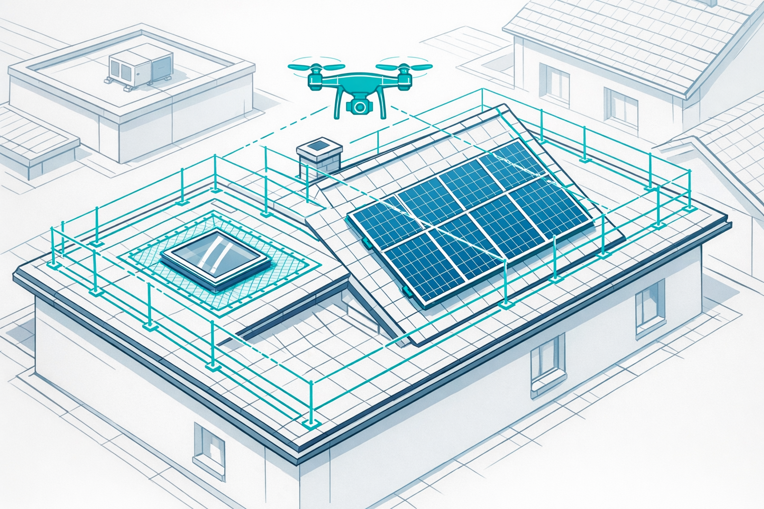
Most camera drones up to 25 kg fall under the "open category" with the subcategories A1, A2, and A3. Flights beyond visual line of sight or with drones over 25 kg fall under the "specific" or "certified" category. For craft and solar businesses this is rarely relevant.

1.1 EU Categories & C-Classes at a Glance

In practice, three questions matter most:

  1. How heavy is your drone and which C-class does it have?
  2. How close do you fly to people or buildings?
  3. Do you stay within visual line of sight and below 120 m altitude?

The key classes for photography and surveying:

C-class Max. weight Typical use License requirement (open category)
C0 < 250 g Recreational use, simple photo/video drones No EU drone license required if A1 rules are followed
C1 < 900 g Photo/video drones, many standard models EU A1/A3 competency certificate required
C2 < 4 kg Professional surveying & inspection drones A1/A3 plus EU A2 remote pilot license if you fly closer to people

Since 1 January 2024, legacy drones over 250 g without a C-marking can no longer be flown in A2. They are restricted to category A3 (minimum 150 m distance from populated areas). For commercial operations in residential areas, a current C1 or C2 drone is essential.

2. Private vs. Commercial Drone Use: What Changes?

Legally, EU rules focus primarily on risk (weight, environment, proximity to people), not on whether you are flying privately or commercially. In practice, however, there are differences:

Shared requirements:

  • Registration (eID) with the LBA for drones with a camera or ≥ 250 g.
  • Liability insurance.
  • Compliance with EU categories (A1/A2/A3) and German no-fly zones.

Additional commercial requirements (craft, solar, real estate):

  • Higher demands on repeatability & documentation (e.g. quotes, PV planning).
  • Stricter data protection (customer data, license plates, private property).
  • Often higher insurance coverage and extended license requirements (A2).
  • Expectation of robust processes: SOPs, checklists, maintenance records.

For many businesses, it makes sense to separate drone flying from data analysis: you ensure legally compliant flights, and a platform such as the Airteam Fusion Platform handles precise 3D building modelling and planning data.

3. Mandatory Essentials for 2026: Registration, Drone License, Insurance

3.1 Registration & eID with the LBA

Drone operators must register online with the Federal Aviation Office as soon as they operate a drone from 250 g upwards or a drone with a camera (except toys) in the open category.

You receive an eID, which:

  • must be affixed to the drone (e.g. sticker, plate, also inside the battery compartment),
  • must also be entered into the remote ID system for C1-C3 drones.

Even for C0 drones under 250 g with a camera, operator registration is mandatory in Germany - a common misunderstanding among hobby pilots.

3.2 Drone License (A1/A3, A2)

In the open category there are two EU drone licenses:

  • EU A1/A3 competency certificate (basic drone license): Online training and test via the LBA.
  • EU A2 remote pilot certificate (advanced drone license): additional in-person exam plus practical component.

The A1/A3 certificate is mandatory for C1 drones and heavier models; the A2 remote pilot certificate is required if you fly C2 drones closer than 150 m to residential, commercial, or industrial areas or to people.

For C0 drones under 250 g, no EU drone license is required - but the rules (e.g. no crowds, respect for privacy) still apply. Detailed guidance is available in the article Drones Under 250 g: Rules in Detail.

For craft and solar businesses, we recommend the Drone License Guide, which Airteam has developed specifically for roofers, carpenters, and PV installers.

3.3 Drone Insurance

In Germany, liability insurance is legally required for all drones - regardless of whether they are used privately or commercially.

For professionals, it also makes sense to have:

  • higher coverage limits (often ≥ €1 million),
  • explicit inclusion of commercial use in the policy terms,
  • if necessary, co-insurance for employees.

For commercial roof inspections, Airteam recommends liability coverage starting at €900,000, combined with A1/A3 certification and LBA registration.

4. Private Drone Footage: What You Need to Consider in 2026

Typical use cases:

  • Flying over your own house or property.
  • Vacation photos, landscape shots, social media clips.
  • Videos over fields, forests, and natural areas.

Key rules:

  • Max altitude 120 m (open category)
  • Maintain visual line of sight to the drone
  • Do not fly over crowds of people
  • Keep distance from airfields (min. 1.5 km) and critical infrastructure

For C0 drones (< 250 g, e.g. DJI Mini):

  • No license required
  • Registration with the LBA if a camera is installed
  • Flights in residential areas are allowed with the property owners' consent and compliance with data protection rules

Data protection: People may only be recorded if they have given their consent or are unrecognisable in the footage. Inform your neighbours before flying, especially in densely built-up areas.

5. Commercial Drone Footage: Roofs, PV & Inspection

For businesses (roofers, solar installers, carpenters, scaffolding companies, real estate), the drone is a tool - with different requirements compared to hobby flying.

Typical applications:

  • 3D roof measurement (for quotes, cost calculation, material planning)
  • PV planning, shading analysis, layout plans
  • Thermography inspections of PV systems and flat roofs
  • Facade and scaffolding planning

In its practical guides, Airteam demonstrates that drone-based surveying can save up to 90% of time and achieve accuracy of up to 99.9% in line with DIN standards.

In 2026, for commercial work you should at minimum plan for:

  • A C1 or C2 drone with remote ID and geo-awareness
  • EU A1/A3 competency certificate, often A2 as well
  • Documented operating procedures (checklists, maintenance)
  • Data protection agreements with clients

If you offer drone inspections commercially (e.g. roof inspections), a structured process is essential. Airteam provides a dedicated guide with minimum requirements and pricing recommendations.

6. Overview by Federal State: Where Are There Special Rules?

Nationwide rules (EU regulation, LuftVG, LuftVO) apply everywhere. Differences arise from:

  • Geo-zones (§ 21h LuftVO: flight restrictions, control zones, U-spaces)
  • Nature conservation and hunting law at state level
  • Municipal bylaws (parks, lakes, city centers)

Since 2022, DIPUL has provided a nationwide central map with all geo-zones. Use DIPUL and its map tool before every flight.

6.1 No-Fly Zones, Regional Hotspots

Strict restrictions apply:

  • around airports and airfields (1.5 km without special permit)
  • over/near government buildings, police, power plants, military facilities
  • in many nature reserves and national parks

Example: In the Bavarian Forest National Park, drones are generally prohibited. Other states such as Lower Saxony or Baden-Württemberg have specific state regulations.

6.2 Federal State Check: Key Special Features

The following table highlights important state-specific focus areas for drone flights. It does not replace a detailed check via DIPUL, but it helps you see where authorities scrutinise flights particularly closely.

Federal state Focus areas for drone footage Practical tip
Baden-Württemberg Many protected areas, dense industrial zones Check protected areas & airports via DIPUL; apply early for permits near hospitals and power plants.
Bavaria National parks, large protected areas National parks are no-drone zones; in alpine valleys & around lakes always check geo-zones & conservation rules.
Berlin Densely populated, many government buildings Follow LuBB guidance; flights in the inner city almost always require permits, check outskirts in DIPUL.
Brandenburg Natural areas, protected zones, military training areas For heath/forest areas: check geo-zones and nature conservation rules.
Bremen City state, port/industrial areas Ports are special protection areas; coordinate commercial flights early.
Hamburg Port, industry, airport Strict distances from port, airport, city center - often special permits required.
Hesse Frankfurt airport, extensive infrastructure Strict control zones in the Rhine-Main area; use DIPUL.
Mecklenburg-Western Pomerania Coastline, national parks, breeding areas Many areas are off-limits to drones; observe seasonal breeding periods.
Lower Saxony Coast, Wadden Sea, farmland Agriculture: special provisions, otherwise comply with nature conservation and hunting laws.
North Rhine-Westphalia Metropolitan triangle, infrastructure, motorways Regional authorities issue their own guidance; clarify city-center flights early.
Rhineland-Palatinate Vineyards, low mountain ranges, military Observe flight restrictions around military training areas and in the Middle Rhine Valley.
Saarland Industrial region/border with France Plan flights near the border, check geo-zones around steel and energy plants.
Saxony Low mountain ranges, tourist hotspots Stricter rules in national parks & tourist zones; observe geo-zones.
Saxony-Anhalt Agriculture, River Elbe, cultural landscapes For World Heritage Sites and cultural monuments: observe specific rules.
Schleswig-Holstein Coast, Wadden Sea, seabird protection areas Wadden Sea and national park are usually no-drone zones; consider port & ferry areas.
Thuringia Forests, biosphere reserves In protected areas/reserves, pay attention to seasonal times and check local rules.

Practical tip: Plan every flight in three steps:

  1. Check the DIPUL map (geo-zones, no-fly zones, airports)
  2. Take nature conservation & local rules into account (national parks, city bylaws)
  3. Inform clients and neighbours whenever you fly in populated areas

7. Professional Drone Footage with Airteam: The Standard Tool for PV, Roofs & Facades

For craft and solar businesses, usable planning data is what really counts. This is exactly where Airteam comes in.

The Airteam Fusion Platform:

  • processes drone footage using AI in the cloud,
  • automatically creates 3D building models according to DIN standards,
  • detects all roof details and surfaces, calculates slopes and dimensions,
  • exports data in more than 15 formats (e.g. PV*SOL, Eturnity, AutoCAD).

In case studies, Airteam shows that 3D models are completed within 24 hours and measurements can be up to 90% faster. With flat rates and credits, you can calculate your costs in a fixed and transparent way.

Work to a consistent standard across all states:

  • Uniform, DIN-compliant measurements nationwide - independent of flight location.
  • Surveying is safely carried out from the air - no more risks on the roof.
  • Identical data structures for your quoting and planning processes.

You can find more details in the Roof Measurement with Drones Guide, which includes concrete practical examples.

8. Conclusion: Flying Legally in 2026 - For Hobbyists and Professionals

To wrap up, here are the most important steps for both groups.

8.1 Checklist for Private Drone Footage

  • Check drone class & weight (C0-C2, < 25 kg, open category)
  • Register with the LBA, attach your eID
  • Extend your liability insurance to include drone operations
  • Check the DIPUL map (airports, protected areas, geo-zones)
  • Maintain safety distances
  • Respect data protection and privacy rights

8.2 Checklist for Professionals (Craft, Solar, Real Estate)

  • Choose a C1/C2 drone with remote ID and geo-awareness
  • Obtain the A1/A3 (and, if applicable, A2) drone license
  • Define operational standards (SOPs, checklists, maintenance)
  • Clarify insurance
  • For each project: perform a DIPUL check + review state/municipal law
  • Use Airteam for surveying and analysis to ensure precision, efficiency, and documentation

This is how you combine legally compliant drone flights with DIN-compliant measurements in 2026 and turn every project into a genuine competitive advantage.

Frequently Asked Questions

Do I always need a drone license in Germany in 2026?

No. For C0 drones under 250 g, it is sufficient to comply with the open category rules; an EU drone license is not required. For C1 or C2 drones - common in commercial use - at least the A1/A3 competency certificate and often also the A2 certificate are mandatory.

What is the legal difference between private and commercial drone use?

EU rules distinguish by risk - not by "private or commercial." However, in the commercial sector there are additional obligations: higher insurance coverage, documentation and data protection duties, and often stricter client requirements.

Am I allowed to film my own house with a drone?

Yes, if you:

  • comply with the open category rules (max. 120 m altitude, visual line of sight),
  • respect geo-zones (especially near airports),
  • only film neighbours/other people with their consent.

You are most flexible with C0 drones - but registration and insurance still apply.

What type of drone insurance makes sense for craft businesses?

At minimum, an aviation liability insurance policy that covers drones and commercial use. By law, liability insurance is mandatory for all drones. In practice, high coverage (at least €1 million), co-insurance for employees, and cross-border protection where needed are important.

When does a solution like Airteam make more sense than your own analysis software?

As soon as you regularly measure roofs or facades - for example for PV projects, refurbishment, or scaffolding planning. In-house photogrammetry workflows are complex and time-consuming. Airteam handles the entire analysis, delivering precise 3D models within 24 hours, saving on average 90% of your time and providing professional, DIN-compliant data. You can focus on consulting, installation, and sales.