Commercial drone footage is a firmly established tool by 2026. From precise roof measurements and solar (PV) inspections to brand films and real estate marketing, drone services have become a real efficiency driver for trades, the solar sector, and the property industry. This guide gives you a clear overview of the different types of drone services, how to realistically estimate costs for drone footage, which technology really matters, and when it makes sense to run your own drone operations instead of relying on external service providers.
1. Market overview 2026: Why professional drone services are booming
According to the latest market analysis, the European market for professional drone services is expected to grow from USD 630 million (2025) to around USD 2.1 billion (2035) - an average annual growth rate of 12.8%.[1] Double-digit annual growth is also forecast for the overall commercial drone market well into the 2030s.[2]
Germany is clearly a frontrunner when it comes to professional deployments:
- Analysis by BDLI: The commercial drone fleet more than doubled between 2019 and 2021 - to over 45,200 drones, an increase of 138%.
- The global drone inspection market is expected to grow at around 14.2% per year through 2033.
Main drivers:
- Cost pressure and skilled labor shortages in the trades
- Climate targets & energy transition (strong PV expansion, building renovation)
- Safety requirements (fewer tasks at height)
- New norms & standards, e.g. DIN-compliant digital measurements
If you are a roofer, solar installer, carpenter, scaffolder, property manager, or energy utility, one thing is clear: in 2026, drones are no longer a "nice-to-have" - they are a strategic tool.
2. What types of professional drone services are there?
2.1 Marketing & real estate: The "drone photographer"
Here the focus is on visual impact:
- Aerial photos and videos of properties (single- and multi-family homes, commercial buildings)
- Brand and image films for trades and solar companies
- Construction site documentation for developers and general contractors
Typical services offered by a drone photographer:
- Photos/videos in 4K or higher
- Basic post-production (editing, color grading)
- Optional: FPV indoor flights, 360° virtual tours, social media formats
This area offers trades businesses in particular a great opportunity to showcase projects professionally and clearly differentiate themselves from the competition.
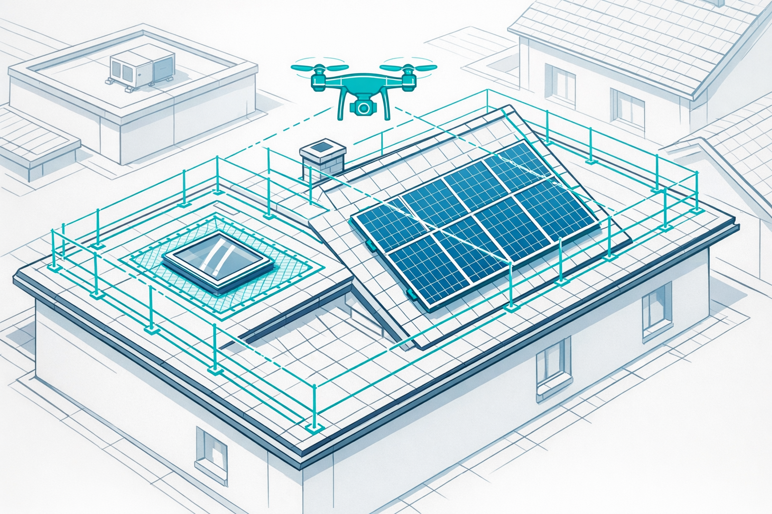
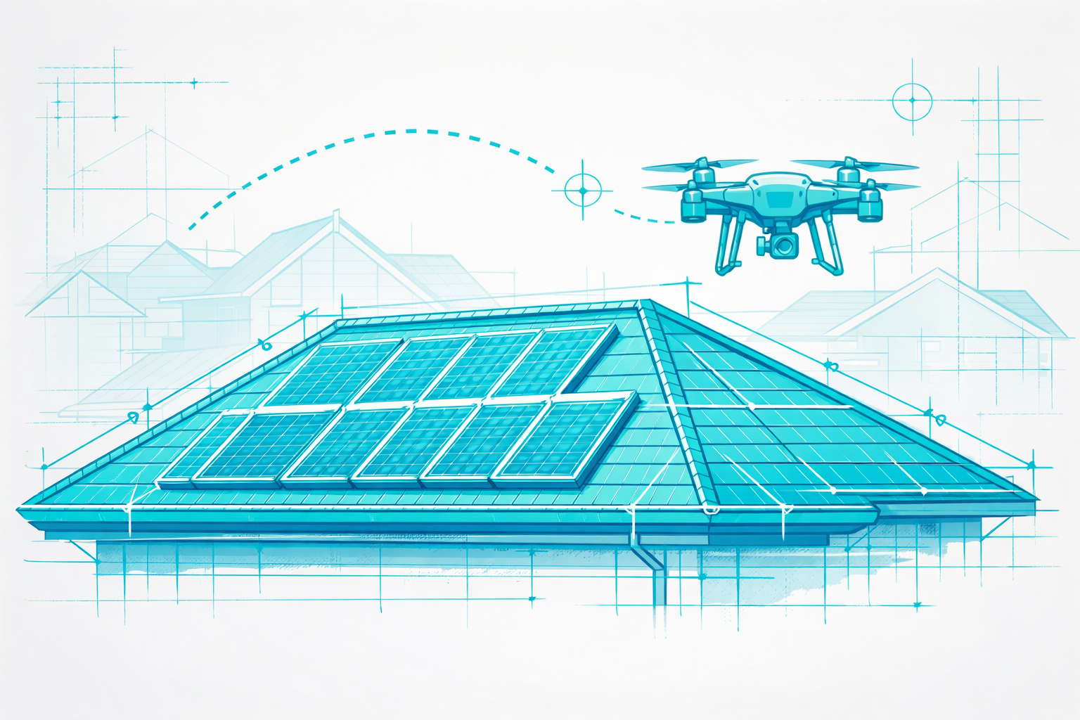
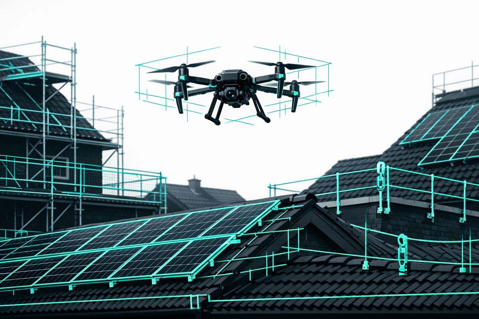
2.2 Drone inspection: Roofs, PV, façades & industrial assets
Drone inspection refers to deployments where the condition of an object is documented:
- Roof inspections for insurers, surveyors, property managers, and roofers
- Thermal inspection of PV systems (hotspots, string faults)
- Façade inspections (cracks, render damage, joints)
- Industrial assets (tanks, pipelines, bridges, towers, masts)
Advantages compared to traditional access methods:
- No risk to your team (no ladders or scaffolding needed)
- Higher level of detail thanks to zoom and thermal cameras
- Documentation as a photo/video report or in combination with 3D models
In this area, Airteam enables particularly efficient and transparent inspections through 3D building models combined with high-resolution photos.
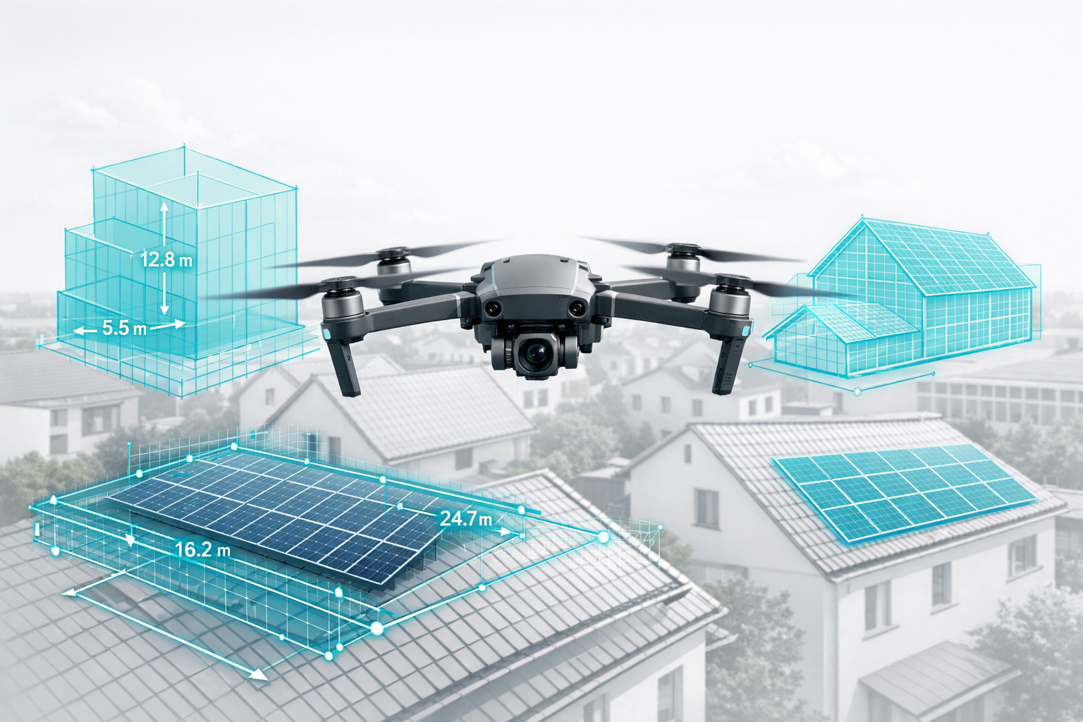
2.3 Surveying & 3D building modelling
Here, metrically accurate data is what counts:
- 3D roof measurements for quotations, VOB-compliant billing, and material calculations
- 3D façade measurements for scaffolding and façade refurbishment
- Terrain models and volume calculations (e.g. landfills, earthworks)
Modern drone services rely on photogrammetry (processing many overlapping photos) or LiDAR (laser scanning). Airteam uses AI-powered methods for roofs and façades.
According to comparative studies, drone photogrammetry can achieve horizontal accuracies down to 1 cm and is suitable for DIN-compliant measurements.
With the Airteam Fusion Platform, you automatically receive 3D models and digital measurements from drone imagery, which you can export directly into common software such as PV*SOL, Eturnity, MF Dach, SEMA, or AutoCAD.
You can find more detail on digital roof measurements in the guide Roof measurement with drones: 90% faster & DIN-compliant.
2.4 Special applications: Thermography, agriculture, infrastructure
Additional use cases for drone footage include:
- Thermal drone inspection of roofs and PV systems
- Agriculture: crop monitoring, nutrient and irrigation management
- Infrastructure: bridges, rail, roads, wind turbines, power lines
The combination of thermography and 3D is particularly efficient for PV inspections, because weaknesses are not only visible but can also be precisely located in 3D space.
3. How much does commercial drone footage cost? - Price guidance by application
3.1 Typical price ranges by type of deployment
The key question: How much does professional drone footage cost?
A current analysis from the Skyzr price radar based on real projects offers guidance:
Simple aerial photos of properties typically cost between EUR 200 and 600, depending on the number of images and post-processing.[3]
Roof and building inspections are usually between EUR 400 and 800, with large or complex assets often costing more.[3]
Surveying/photogrammetry usually starts at around EUR 500 and can reach EUR 2,000-5,000 or more for large areas.[3]
Price overview - typical price ranges:
| Type of deployment | Entry-level price | Standard projects | High effort* |
|---|---|---|---|
| Aerial property photos | from €200 | approx. €250-600 | approx. €600-1,200+ |
| Roof/building inspection | from €300 | approx. €400-800 | approx. €800-1,500+ |
| Thermography / PV inspection | from €200-350 | approx. €300-600 (roofs) | approx. €1,500-2,500/MW |
| Surveying / photogrammetry | from €500 | approx. €800-2,000 | approx. €2,000-5,000+ |
| Film & marketing footage | from €300 | approx. €500-1,500 | approx. €1,500-3,000+ |
*Indicative values depending on asset, region, and scope of services.[3]
Airteam analyses for roof measurements show:
Drone roof inspections often cost EUR 150-400, depending on building size; inspections using scaffolding can add up to around EUR 1,800 in additional scaffolding costs alone.
3.2 Key cost drivers
The main pricing factors are:
- Complexity & duration (short flyover vs. several hours of inspection)
- Equipment (standard camera vs. RTK, thermal camera, LiDAR)
- Post-processing effort (raw data vs. finished report/3D model)
- Permissions (controlled airspace, nature reserves, special conditions)
- Pilot qualifications (including EU remote pilot certificate A2)
- Region & travel (urban vs. rural areas)
- Usage rights for the footage
So never compare on price alone - always scrutinize scope of services and qualifications in detail.
3.3 Example: Cost-effectiveness of drone measurements vs. traditional surveying
Airteam has compared the cost structures:
- Drone photogrammetry for roof measurements typically costs EUR 80-150 per hour (flight plus processing); traditional inspections usually cost EUR 75-200 per visit.
- The measurement process is up to 90% faster, because a short flight captures all roof geometries and cloud-based processing runs automatically.
For recurring tasks (PV, refurbishment, scaffolding), a drone service quickly pays off - whether via an external partner or your own setup with software like the Airteam Fusion Platform.
4. Technology & data quality: What really matters when comparing drone services
4.1 Sensors & cameras: RGB, thermography, multispectral, LiDAR
Your results depend directly on the sensor package:
- RGB camera: standard for photos, video, orthophotos, and 3D models
- Thermal camera: detects temperature differences, ideal for PV and leaks
- Multispectral sensors: relevant for agriculture
- LiDAR sensors: fast, dense point clouds for corridors and infrastructure
For roof, façade, and PV projects, a high-quality RGB camera combined with precise flight planning and powerful photogrammetry software is usually sufficient.
4.2 Photogrammetry vs. LiDAR - which approach suits whom?
In surveying applications, the following generally applies:
- Photogrammetry
- Very high accuracy (down to the centimetre range)
- Photorealistic textures - ideal for client communication
- Slightly longer processing times
- LiDAR
- Strong for narrow structures (lines, edges)
- Very high point density, even through vegetation
- Fast data processing
For roof measurements, photogrammetry can achieve accuracies of around 1 cm; LiDAR shines with speed and handling of complex geometries.
For trades businesses, photogrammetry is usually the better option: high accuracy, compelling visualisation, and lower hardware costs.
You can find more details on software in the Airteam article Drone photogrammetry software 2025: comparison for trades & construction.
4.3 Accuracy & standards: Why DIN-grade data matters
For quotations, invoicing, and liability, norms and standards are becoming increasingly important:
- Precise area and length measurements are the basis for VOB-compliant quotations.
- In case of disputes, measurements must be objectively verifiable.
- Digital measurements in line with DIN standards are increasingly being required.
Airteam achieves up to 99.9% accuracy, with typical tolerances of 1-3 cm when flying at 40 m altitude.
More than 5,000 companies have digitally surveyed over 70,000 projects with Airteam - usually without rework and with significantly fewer planning errors.
With DIN-compliant digital measurements, you gain a legally robust foundation for your business.
5. Law & safety: What you must consider for commercial drone flights
5.1 EU drone classes & licenses at a glance
Since 2021, uniform rules apply across Europe. Drone flights in the open category are subdivided into A1, A2, and A3.[4]
Relevant for commercial operations:
- A1/A3 (EU basic certificate): for drones with a camera from 250 g
- A2 (EU remote pilot certificate): for flights close to people/built-up areas
For many roof inspections, at least the EU remote pilot certificate A2 is required; preparation and exams usually cost a low to mid three-digit amount.
5.2 Insurance & liability
Aviation liability insurance is mandatory for commercial drone flights.
Industry sources recommend minimum coverage between EUR 750,000 and 900,000.
Important points:
- Check whether commercial use is included.
- Ensure coverage for property damage, personal injury, and financial losses.
- Ask about special conditions for sensitive environments (e.g. industrial sites).
An established drone service provider usually handles insurance and regulatory compliance end to end.
6. ROI & efficiency: When to build in-house capability and when to use external services
6.1 External drone services: Quick start, predictable costs
Advantages:
- No investment in drones, training, insurance, or software
- Predictable costs per project (e.g. roof inspection EUR 400-800, PV thermography from EUR 200-350)
- No effort for permits and approvals
- Access to specialist expertise
Ideal for you if you:
- only need occasional drone deployments
- work in highly regulated zones
- or want to test drone use before committing
6.2 In-house drone operations: Efficiency for high-volume users
If you regularly document roofs, façades, or PV systems, in-house operations are usually cost-effective after a short time:
- Savings on travel and appointment coordination
- Rapid response (e.g. after storm damage)
- Building internal expertise - a clear competitive edge
Airteam customers report from real-world practice:
- up to 90% time savings on measurements
- 48% shorter planning times for PV projects
- 25% lower project costs due to fewer reworks
Regular surveying becomes especially attractive with drones + Airteam Fusion Platform + flat-rate/credits.
You can learn more in the Airteam solutions for PV planning: Using drones and AI for perfect PV planning.
6.3 A simple way to calculate ROI
A practical rule of thumb:
- Estimate time saved per project (e.g. 3 hours less for roof measurement)
- Multiply by your internal hourly rate (e.g. 3 h × EUR 60/h = EUR 180)
- Add in savings on scaffolding, ladders, travel
- Compare internal vs. external costs
With just 2-3 measurements per week, a dedicated setup with automated 3D building modelling usually pays for itself.
7. Market trends 2026: Where drone services are heading
Current developments you should be aware of:
- More AI in analysis & planning
Automatic component recognition, shading analysis, and defect classification - Airteam is setting benchmarks here with AI-based component detection and automated planning outputs. - Standardized interfaces
Direct exports into PV design tools, roofing software, and CAD are becoming standard; integrations are expanding (e.g. PVcase, Eturnity, SolarEdge Designer). - DIN specifications increase legal certainty
Digital roof measurements based on clear standards benefit tender processes, insurers, and public authorities. - From single images to digital twins
Professionals are demanding more - complete 3D models and data that is ready for planning. - Drone-as-a-Service models
Platforms connect pilots, while specialized providers like Airteam handle data processing and 3D modelling.
Those who invest now in digital, standardized drone data will secure a lasting competitive advantage.
8. How to find the right drone service for your project
8.1 Checklist for choosing a service provider
Pay attention to the following points:
- Define your objective: photos, inspection report, or fully surveyed 3D data?
- Qualifications: EU basic certificate A1/A3, and if required, A2 remote pilot certificate?[4]
- Insurance: aviation liability insurance with sufficient cover
- References & examples: for surveying/PV planning, insist on sample projects
- Clear scope of services:
- Number of photos/videos
- Level of post-processing
- Delivery formats (e.g. DXF, DWG, OBJ, PV*SOL)
- Turnaround times: when will the finished data be delivered (e.g. 24 hours for a 3D model, 2-7 days for planning data)?
8.2 Practical tip for trades & solar businesses
If you regularly survey roofs and design PV systems:
- Invest in your own drone plus team training
- Use automated 3D processing via cloud software such as the Airteam Fusion Platform
This way, you retain full control on site while benefiting from efficient cloud workflows for precision, DIN compliance, and data export.
You can find more examples in the success stories on the Airteam website.
Conclusion: Next steps for your commercial drone footage
- By 2026, commercial drone footage is economically established - especially for roofs, PV, façades, real estate, and marketing.
- You can plan costs reliably if you clearly define the type of deployment, the data you need, and the level of post-processing.
- With the right drone, AI-powered 3D building modelling, and industry software, you save time, reduce risks, and cut planning errors.
What a fully integrated workflow looks like is explained in the guide Using drones & AI for 3D roof measurements.
Frequently Asked Questions
What is the difference between drone photography and drone inspection?
Drone photography delivers aesthetic photos and videos for real estate, marketing, or social media, where visual impact and perspective are key.
With drone inspection, the technical result is the main focus: documenting cracks, defects, or hotspots (often using thermal cameras and structured reports). For many trades businesses, this is the typical entry point.
How accurate are drone-based measurements compared to traditional methods?
With professional hardware, flight planning, and software, you can achieve centimetre-level accuracy.
Studies and real-world projects show that drone photogrammetry delivers horizontal accuracies for roofs of around 1 cm and overall system accuracies of up to 99.9%.
Digital drone-based measurements are therefore often more accurate and more repeatable than manual measurements - and take significantly less time.
When does it make sense to buy a drone instead of hiring a service provider?
A rough guide:
- Fewer than 1-2 deployments per month: external services are usually more economical.
- Several deployments per week (e.g. regular roof measurements, PV): an in-house setup with drone, team training, and a platform like Airteam Fusion often pays off within a few months.
The decisive factor is whether you have recurring, standardizable tasks - that is where drones and AI deliver the greatest benefits.
What deliverables should a professional drone service provide?
As a minimum:
- Raw data (photos/videos) in high resolution
- Optional: orthophoto, 3D model, point cloud
- For inspections: a clearly structured photo report (e.g. numbered photos, location descriptions)
- For surveying: metrically accurate data (DWG/DXF, JSON, CSV) for integration into industry software
Depending on the assignment, you may also receive evaluation reports (e.g. thermography reports).
How can I ensure data security and legal compliance for drone footage?
Key points to watch:
- Only work with pilots who can provide EU licenses (A1/A3, and if applicable A2)
- Check whether the flight location is in a special zone or no-fly zone and whether permits are required
- Observe data protection rules (avoid or anonymize people, neighboring properties, vehicle license plates)
Many professionals will handle permits and data protection measures for you - just make sure you clarify this in advance!