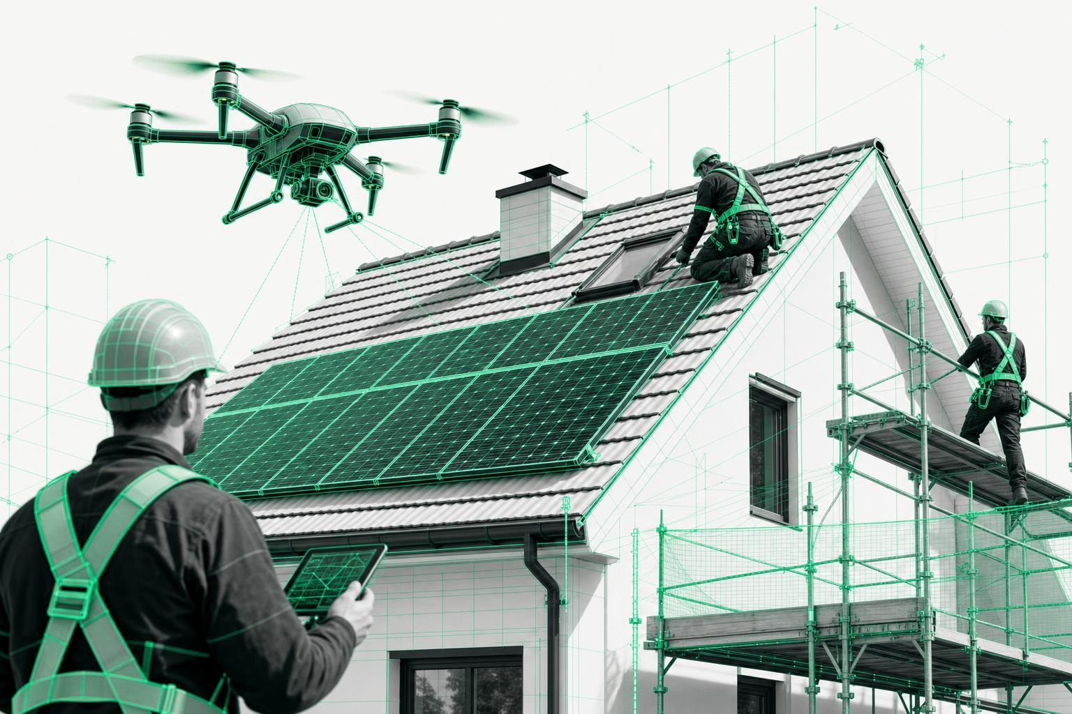
Drone imagery for roof measurement has become everyday routine in the trades: you can save up to 90% of the time you spend measuring, you no longer need ladders, and you get centimeter-accurate 3D models for estimating, planning, and billing.
At the same time, many companies are asking an important question: What about data protection and privacy rights when a drone flies over a house?
What about people walking past, neighboring properties, or parked cars?
This article gives you a practical overview - with a clear conclusion:
Data protection is not an obstacle to professional roof surveying with drones.
If you follow a few basic rules, you can work in a legally compliant, efficient, and relaxed way.
1. Typical data protection concerns with drone imagery
From conversations with roofers, solar installers, and carpenters, we hear the same concerns again and again:
- "What if someone happens to walk through the frame?"
- "Are license plates or faces visible in the drone imagery?"
- "Do I have to ask all the neighbors for permission before I measure a roof?"
- "Am I violating the GDPR if I use drones for roof surveys?"
These questions are completely understandable. Legally, drones are classified as aircraft, and you are not allowed to film or photograph people at will without their consent - that also applies from the air.
The good news:
With a professional drone roof survey, the focus is not on people, but solely on the building and its geometry. That is exactly the key point when it comes to data protection.
2. Legal framework: GDPR & drone regulations - in brief
You do not need to be a lawyer to work correctly. It is enough to understand the core principles:
GDPR principle: Avoid personal data
The GDPR protects "personal data" - anything that can be used to identify an individual (for example, a face, license plate, or name).
For drone imagery, this means:
- Capturing people without their consent is off-limits.
- You must not capture or store targeted footage of individuals.
- The data may be processed only for the stated purpose (in this case: roof surveying / roof measurement).
Drone rules: Property owners and flight zones
For typical roof surveys with a professional drone, the following applies in most jurisdictions:
- You may generally fly over residential areas if you have the property owner's consent.
- Certain zones (airports, active police or emergency sites, industrial facilities, etc.) are off-limits or require special permission.
- You must comply with registration, insurance, and, where applicable, EU drone license requirements - this is standard practice for professional service providers.
Airteam supports its customers precisely with these legal questions and with obtaining any required permits, so you can focus on your trade.
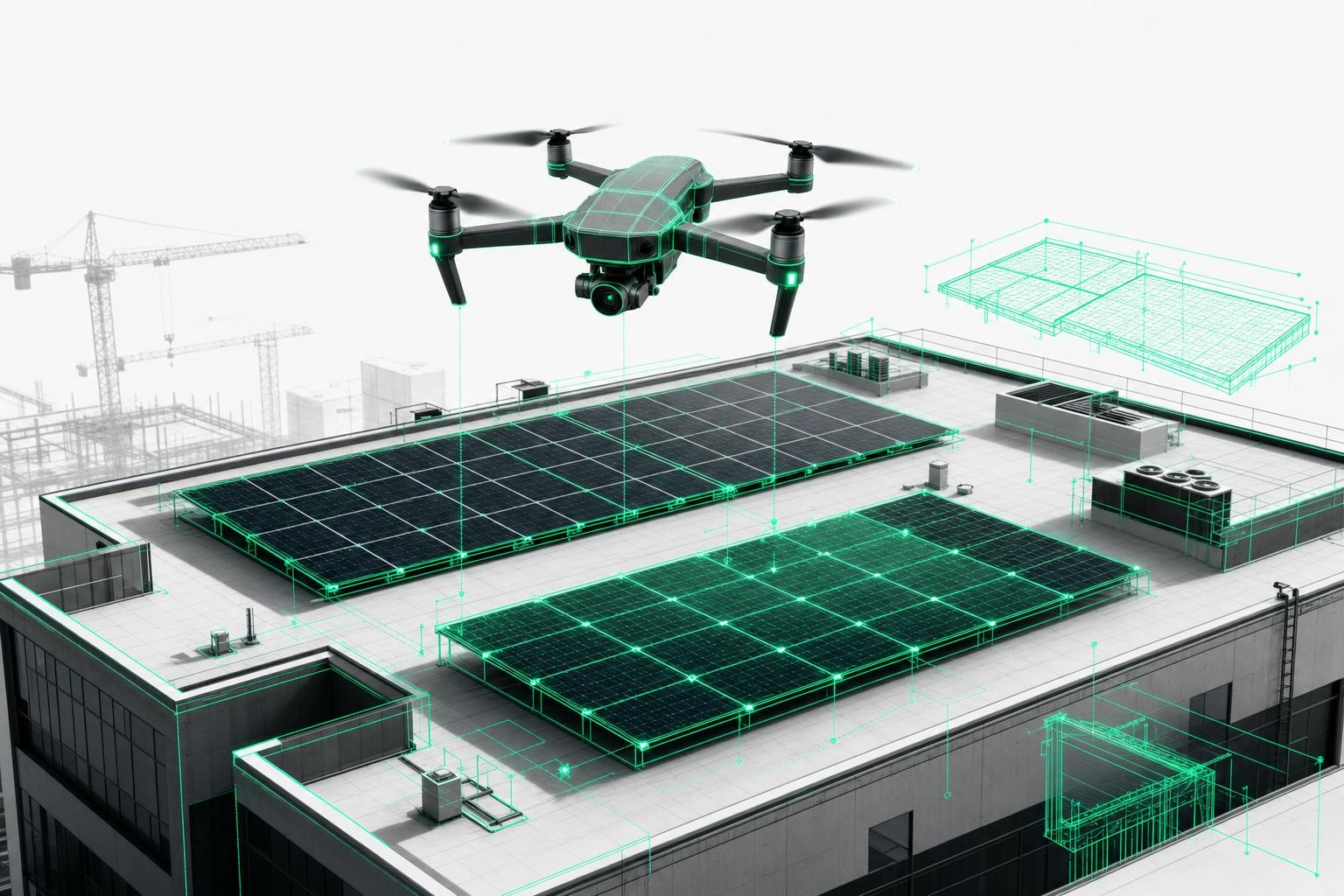
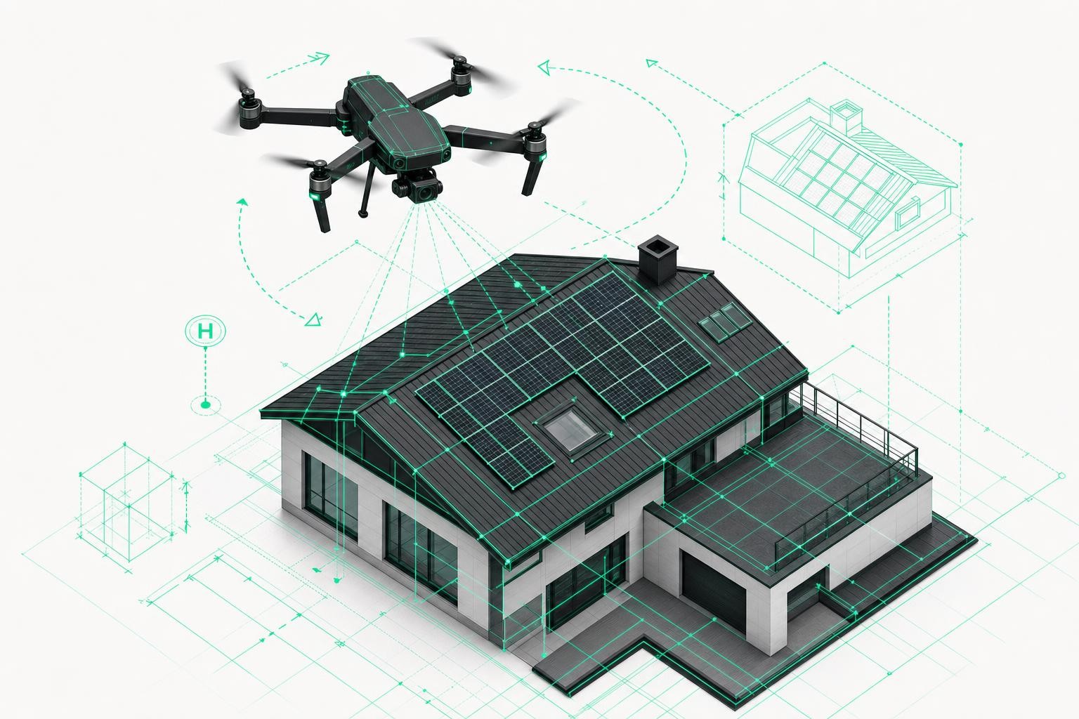
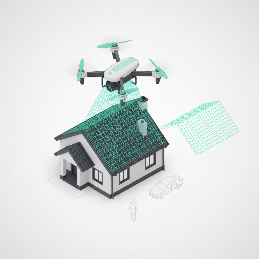
3. How drone-based roof surveying works technically - and what is actually in the image
To properly assess data protection, it helps to understand the technology behind drone roof measurement.
Focus on the roof, not the yard
For drone-based roof measurement:
- the drone flies at a defined height over the building,
- captures serial images using a downward-facing camera,
- and uses them to generate, via photogrammetry, a 3D model with all relevant roof surfaces, dormers, chimneys, and more.
Airteam's AI software automatically detects and classifies relevant building structures and distinguishes between roof, facade, and other elements.
Important:
For roof measurement, the software is only interested in static points on the building (tiles, edges, dormers, ridges).
Moving objects - such as people or vehicles arriving or leaving - are useless for calculating the 3D model and are not incorporated as geometry.
Moving people: Effectively invisible in the model
Photogrammetry works like this:
- Several slightly offset images of the same static point are combined into a single 3D point.
- Anything that moves between images (a person, car, or dog) does not generate stable correspondences - the software discards this image information.
For your roof survey, this means:
- People who just walk through the scene do not show up as usable structures in the 3D roof model.
- The final model contains roof surfaces, edges, and structures - but no people.
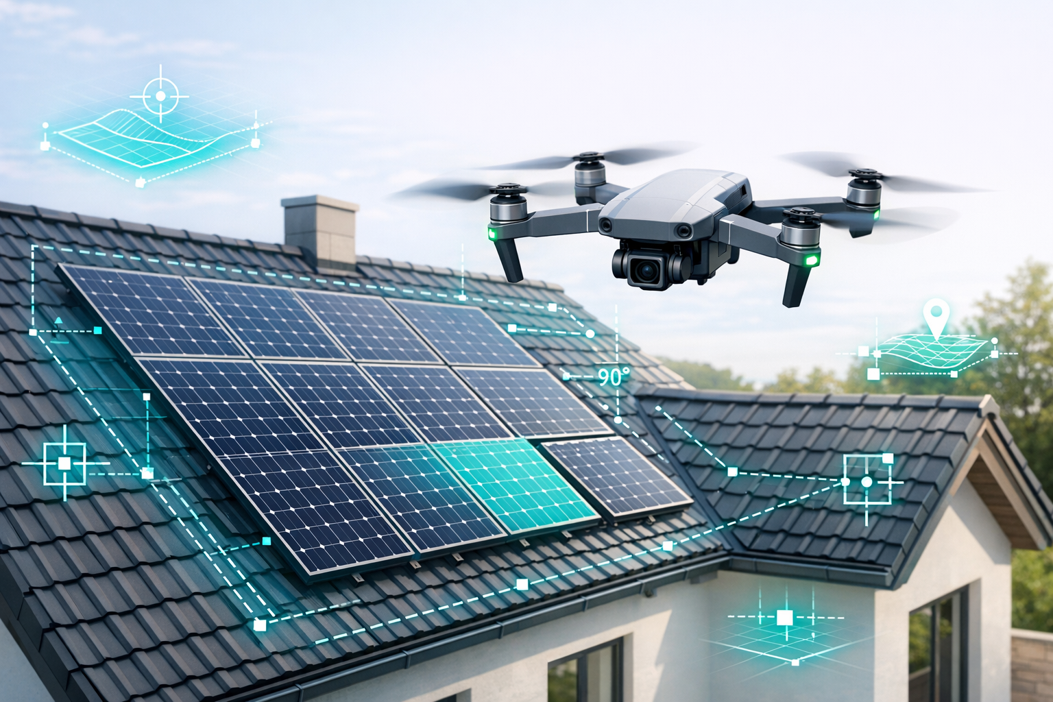
Parked cars, license plates & neighboring properties
On individual images, it can happen that:
- a parked car is visible,
- a portion of the neighboring yard is in the frame.
In the context of roof surveying, the following points apply:
- The drone usually flies high enough that the roof is captured with centimeter-level accuracy, while the ground area remains small and irrelevant.
- License plates and faces are
- outside the focus,
- irrelevant to the measurement,
- and not used as geometry.
This respects the core of the GDPR:
The actual processing is limited to building structures, not personal details.
4. What professional providers like Airteam do in addition for data protection
Beyond the technology, organizational measures play a major role. Reputable providers follow these key GDPR principles:
1. Purpose limitation
- Imagery is used only for roof measurement, planning, and documentation.
2. Data minimization
- Only what is necessary for roof measurement is captured.
- The AI ignores irrelevant areas.
3. Access control
- Access is restricted to authorized personnel only (site management, estimators, project management).
- Secure cloud platforms are used instead of loose folders of image files.
4. Transparency towards owners and neighbors
- Property owners are informed in advance.
- Optionally: a notice in the building or a brief heads-up to neighbors.
5. Deletion & retention
- Data is stored only as long as necessary for the contract, documentation, or proof.
This way, you comply with the GDPR, have reliable documentation - and respect the rights of others.
5. Why data protection is not a showstopper for digital roof surveys
The key points for your day-to-day operations:
Roof measurements, not people shots
The drone is there to measure roofs, not people. Moving individuals do not appear in the 3D model.The legal framework is manageable
With the owner's consent and compliance with flight rules, you are on safe ground.Professional workflows are GDPR-compliant
Purpose limitation, data minimization, access control - these are standard when using platforms such as Airteam Fusion.More safety & efficiency
Up to 90% time savings, 99.9% accuracy, and significantly reduced risk.
Conclusion:
If you plan properly, inform the property owner, and work with a professional partner such as Airteam, data protection is not an obstacle but an integral part of a modern, digital approach to roof measurement.
6. FAQ: Common questions about data protection in drone-based roof surveys
Am I allowed to fly a drone over residential areas?
Yes - with the consent of the property owners and in compliance with applicable flight zone rules.
What about people walking past?
Moving people are not included in the 3D roof model.
You should still avoid deliberately capturing individuals.
Are license plates or faces visible?
As a rule, they are not relevant and are not part of the evaluated geometry.
The focus is on the roof, not the ground area.
Do I have to inform neighbors?
Not always a legal requirement, but in practice very helpful to avoid disputes.
If you want to see what a GDPR-compliant drone and AI-based roof survey would look like in your business, you can test Airteam free of charge - including drone imagery, a full 3D roof model, and a complete measurement report.